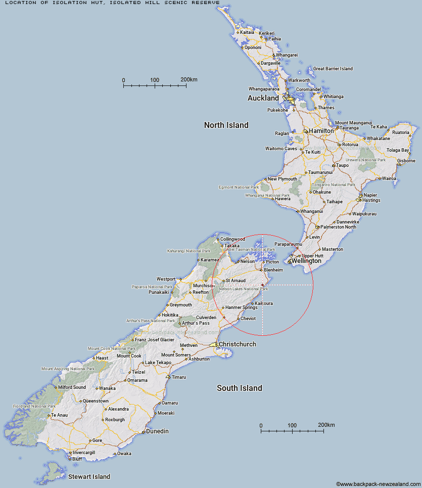
Topo Map showing location of Isolation Hut
This information is sourced from DoC, LINZ and Openstreetmap. Some of the hut photos are mine and the rest are from DoC. I will be adding an upload feature soon so people can photos of .Isolation Hut.
Basic info: standard 6-bunk hut in the South Marlborough area.
Latitude: -41.8993893283
Longitude: 173.985022133
Location: Isolated Hill Scenic Reserve
Area: Marlborough
Type of Hut: Standard
Tracks: Sawcut Gorge/Isolated Hill Route
Map: BS28 Topo Map | Road Map
Does this hut still exist? Have any more information? Contact
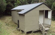
Image: DoC
Scroll down to see a topographical map and road map showing the location of Isolation Hut
[ A ] [ B ] [ C ] [ D ] [ E ] [ F ] [ G ] [ H ] [ I ] [ J ] [ K ] [ L ] [ M ] [ N ] [ O ] [ P ] [ Q ] [ R ] [ S ] [ T ] [ U ] [ V ] [ W ] [ Y ] [ Z ]
Closest 20 Huts to Isolation Hut
These are as the crow fliesZoo Hut 5.46km Whernside Hut 7.12km Beechs Hut 10.63km Swale Hut 11.61km Cabbage Tree Hut 15.42km Mead Hut 16.8km Flynns 17.01km Gibson Hut 18.64km Dee Hut 22.45km Cam Hut 23.62km Black Birch Bivouac 24.35km Snowgrass Hut 26.47km Hornby Bivvy 27.1km Penk Hut 27.92km Omaka Bivouac 28.43km Tinpot Hut 30.17km Dillon Hut 30.23km Beehive Hut 30.24km Jam Hut 31.19km Lake Alexander Hut 31.54km Ramshead Hut 33.1km McNaughts Hut 33.65km Haycocks Bivouac 34.15km Ravine Hut 34.22km Old Middlehurst Hut 38.95km Fidgit Bivouac 42.56km Goose Flat Hut 45.49km Barratts Bivouac 46.18km Barratts Hut 46.28km Top Whare 46.48km Dubious Bivouac 49.63km Hapuku Hut 49.79km Limestone Hut 54.62km Chimney 54.74km Kowhai Hut 54.8km Blue Mountain Hut 54.87km Gosling Hut 55.19km Burnt Yards Hut 57.13km Mt Fyffe Hut 57.21km Turkeys Nest Bivouac 57.5km