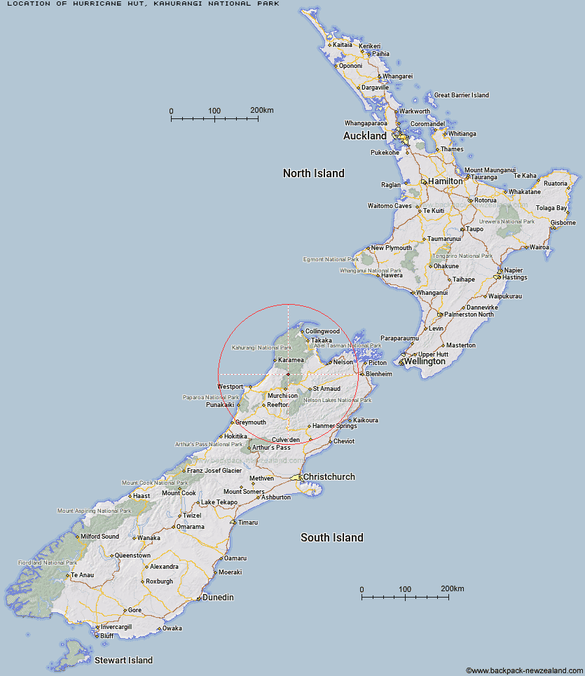
Topo Map showing location of Hurricane Hut
This information is sourced from DoC, LINZ and Openstreetmap. Some of the hut photos are mine and the rest are from DoC. I will be adding an upload feature soon so people can photos of .Hurricane Hut.
Basic info: basic 4-bunk hut in the Nelson Lakes area.
Latitude: -41.5067709257
Longitude: 172.382627365
Location: Kahurangi National Park
Area: Nelson/Tasman
Type of Hut: Standard
Tracks: Matiri Valley and 1000 Acre Plateau tramping tracks
Map: BR23 Topo Map | Road Map
Does this hut still exist? Have any more information? Contact
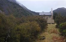
Image: DoC
Scroll down to see a topographical map and road map showing the location of Hurricane Hut
[ A ] [ B ] [ C ] [ D ] [ E ] [ F ] [ G ] [ H ] [ I ] [ J ] [ K ] [ L ] [ M ] [ N ] [ O ] [ P ] [ Q ] [ R ] [ S ] [ T ] [ U ] [ V ] [ W ] [ Y ] [ Z ]
Closest 20 Huts to Hurricane Hut
These are as the crow fliesLarrikin Creek Hut 8.1km McConchies Hut 9.1km Cecil Kings Hut 9.19km Kings Creek Hut 9.41km Johnson Hut 9.89km Helicopter Flat Hut 10.25km Stone Hut 10.68km Branch Creek Hut 10.85km Trevor Carter Hut 12.1km Poor Pete's Hut 12.95km Taipo Hut 13.4km Stag Flat Shelter 14.25km Kiwi Saddle Hut 14.49km Granity Pass Hut 14.97km Wangapeka Bivouac 16.64km Lake Matiri Hut 17.16km Mokihinui Forks Hut 17.6km Thor Hut 17.71km John Reid Hut 18.14km Goat Creek Hut 18.86km Specimen Point Hut 19.64km Kākāpō Hut 20.47km Belltown Manunui Hut 21.26km Venus Hut 21.64km Stern Valley Hut 23.19km Crow Hut 24.78km Ghost Lake Hut 28.42km Greys Hut 31.07km Flanagans Hut 31.39km Karamea Bend Hut 32.26km Lyell Saddle Hut 33.73km Roaring Lion Hut 34.61km Adams Flat Hut 37.2km Splugeons Rock Shelter 38.46km Ellis Hut 39.17km Sunshine Flat Shelter 40.16km Balloon Hut 42.55km Dry Rock Shelter 43.31km Mt Arthur Hut 44.2km Growler Rock Shelter 44.98km