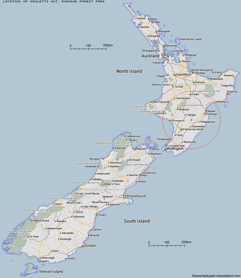
Topo Map showing location of Howletts Hut
This information is sourced from DoC, LINZ and Openstreetmap. Some of the hut photos are mine and the rest are from DoC. I will be adding an upload feature soon so people can photos of .Howletts Hut.
Basic info: standard eight-bunk hut in the Hawke's Bay region.
Latitude: -39.9043660827
Longitude: 176.126346851
Location: Ruahine Forest Park
Area: Hawke's Bay
Type of Hut: Standard
Tracks: Kashmir Road tramping tracks
Map: BL36 Topo Map | Road Map
Does this hut still exist? Have any more information? Contact
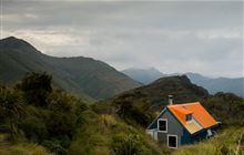
Image: DoC
Scroll down to see a topographical map and road map showing the location of Howletts Hut
[ A ] [ B ] [ C ] [ D ] [ E ] [ F ] [ G ] [ H ] [ I ] [ J ] [ K ] [ L ] [ M ] [ N ] [ O ] [ P ] [ Q ] [ R ] [ S ] [ T ] [ U ] [ V ] [ W ] [ Y ] [ Z ]
Closest 20 Huts to Howletts Hut
These are as the crow fliesDaphne Hut 1.82km Tarn Bivouac 2.76km Triangle Hut 4.33km Longview Hut 5.24km Hinerua Hut 6.01km Pourangaki Hut 6.4km Iron Gate Hut 6.42km Smiths Stream Hut 7.2km Top Gorge Hut 7.25km Awatere Hut 7.47km Waterfall Hut 8.45km Kelly Knight Hut 8.68km Rangiwahia Hut 9.33km Toka Bivouac 9.9km Waikamaka Hut 10.34km Happy Daze Hut 10.4km Alice Nash Memorial Heritage Lodge 10.84km Makaretu Hut 11.01km Purity Hut 11.1km Leon Kinvig Hut 11.89km Waipawa Forks Hut 12.46km Sunrise Hut 13.47km Triplex Hut 13.78km McKinnon Hut 13.91km Top Maropea Hut 14.7km Crow Hut 15.68km Ngamoko Hut 15.85km Wakelings Hut 16.65km Gold Creek Hut 16.96km Kawhatau Base 17.55km Piripiri Hut 17.65km Norris Hut 17.87km Mid Pohangina Hut 18.38km Cattle Creek Hut 18.74km Sparrowhawk Bivouac 19.04km Maropea Forks Hut 19.44km Stanfield Hut 21.48km Barlow Hut 22.35km Otukota Hut 22.58km Traverse (A Frame) Hut 24.5km