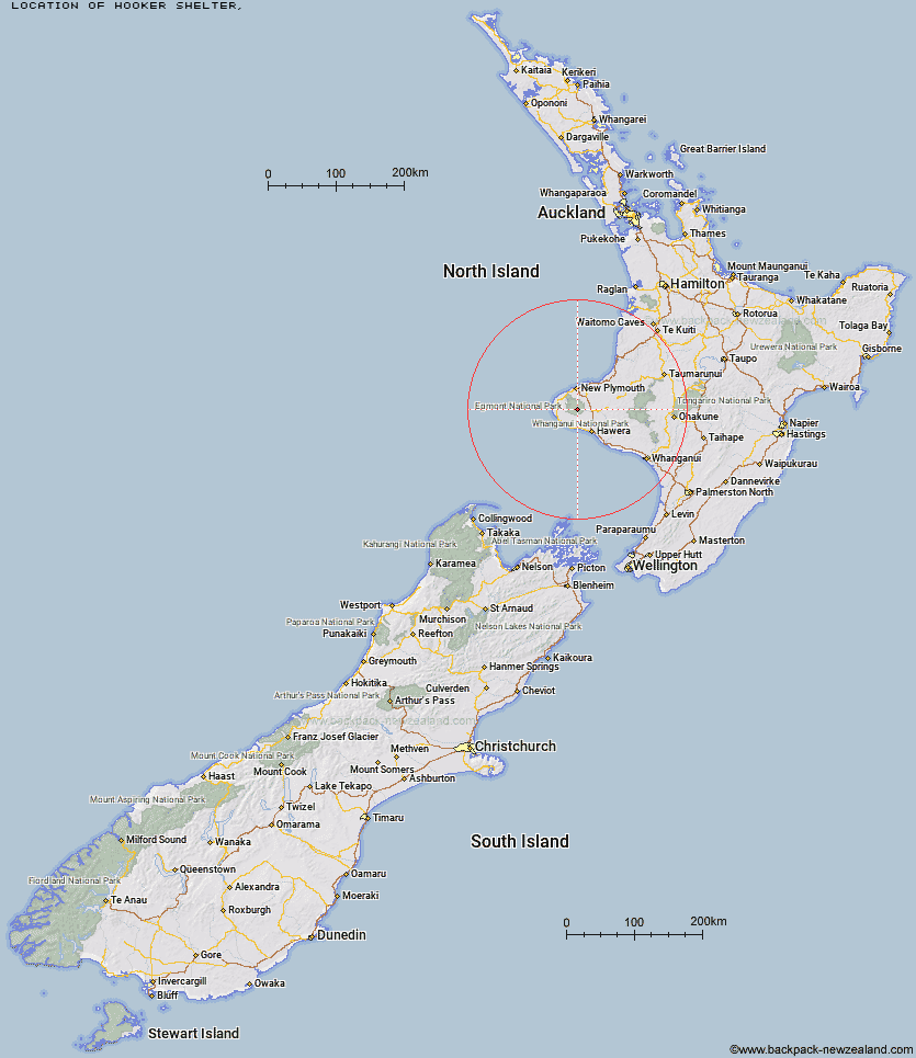
Topo Map showing location of Hooker Shelter
This information is sourced from DoC, LINZ and Openstreetmap. Some of the hut photos are mine and the rest are from DoC. I will be adding an upload feature soon so people can photos of .Hooker Shelter.
Latitude: -39.3175914995
Longitude: 174.087750125
Location:
Type of Hut:
Map: Topo Map | Road Map
Does this hut still exist? Have any more information? Contact
Latitude: -39.3175914995
Longitude: 174.087750125
Location:
Type of Hut:
Map: Topo Map | Road Map
Does this hut still exist? Have any more information? Contact
Scroll down to see a topographical map and road map showing the location of Hooker Shelter
[ A ] [ B ] [ C ] [ D ] [ E ] [ F ] [ G ] [ H ] [ I ] [ J ] [ K ] [ L ] [ M ] [ N ] [ O ] [ P ] [ Q ] [ R ] [ S ] [ T ] [ U ] [ V ] [ W ] [ Y ] [ Z ]
Closest 20 Huts to Hooker Shelter
These are as the crow fliesWaingongoro Hut 1.96km Syme Hut 2.08km Lake Dive Hut 3.1km Maketawa Hut 4.11km Holly Hut 6.8km Kahui Hut 6.82km Waiaua Gorge Hut 7.28km Kaiauai Shelter 8.7km Pouakai Hut 10.14km Waiweranui Trust Hut 11.77km Trains Hut 58.06km Omaru Hut 59.47km Tahupo Hut 60.4km Puteore Hut 60.64km Pouri Hut 65.71km Rerekapa Hut 69.29km Ngapurua Hut 70.82km John Coull Hut 71.69km Puketotara Hut 76.52km Tieke Kainga 77.91km Ohuraiti Hut 86.89km Downes hut 100.4km Leitchs Hut 115.21km Mangaturuturu Hut 121.68km Ten Man Hut 121.92km Lupton Hut 123.39km Whakapapaiti Hut 123.4km Blyth Hut 123.64km Mangaehuehu Hut 125.8km Whangaehu Hut 129.2km Mangatepopo Hut 131.38km Rangipo Hut 132.17km Ketetahi Shelter 136.85km Old Waihohonu Hut 136.97km Waihohonu Hut 137.59km Hauhungaroa Hut 138.75km Oturere Hut 139.05km Zekes Hut 144.65km Hamilton Tomo Group Hut 146.79km Waihaha Hut 147.93km