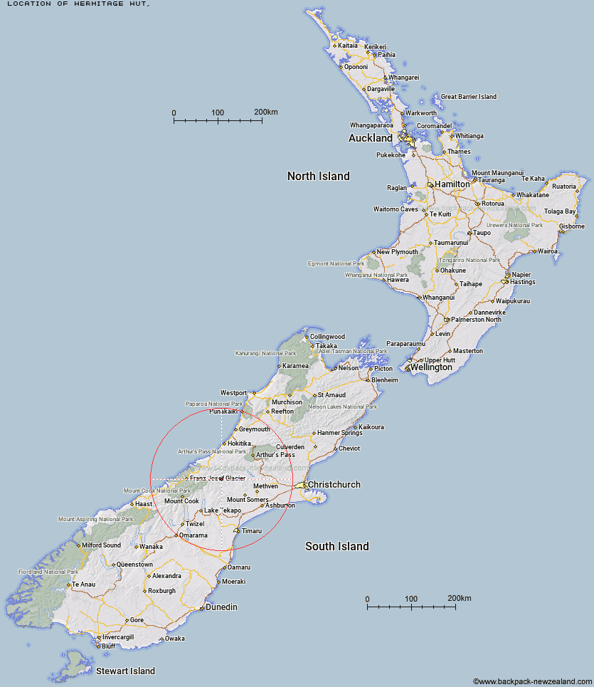
Topo Map showing location of Hermitage Hut
This information is sourced from DoC, LINZ and Openstreetmap. Some of the hut photos are mine and the rest are from DoC. I will be adding an upload feature soon so people can photos of .Hermitage Hut.
Latitude: -43.4015995412
Longitude: 170.908112892
Location:
Type of Hut:
Map: Topo Map | Road Map
Does this hut still exist? Have any more information? Contact
Latitude: -43.4015995412
Longitude: 170.908112892
Location:
Type of Hut:
Map: Topo Map | Road Map
Does this hut still exist? Have any more information? Contact
Scroll down to see a topographical map and road map showing the location of Hermitage Hut
[ A ] [ B ] [ C ] [ D ] [ E ] [ F ] [ G ] [ H ] [ I ] [ J ] [ K ] [ L ] [ M ] [ N ] [ O ] [ P ] [ Q ] [ R ] [ S ] [ T ] [ U ] [ V ] [ W ] [ Y ] [ Z ]
Closest 20 Huts to Hermitage Hut
These are as the crow fliesLawrence Hut 2.87km Lawrence Bivouac 5.88km Erewhon Station Hut 6.99km Cameron Hut 9.68km Watchdog Hut 9.7km Top Hut 9.98km McCoy Hut 11.02km Potts Hut 11.15km Lyell Hut 11.4km Highland Home 13.39km Reischek Hut 14.28km Lauper Bivouac 15.5km Banfield Hut 16.57km Washbourne Hut 16.65km Curtis Memorial Hut 16.78km Black Mountain Hut 16.92km Thompsons Hut 17.76km Mistake Flats Hut 18.08km Saint Winifreds Hut 18.26km Growler Hut 18.29km Evans Hut 18.65km Downs Hut 19.09km Boundary Creek Hut 19.39km Murphys Bivvy 20.03km Jellicoe Hut 21.44km Dog Kennel Bivouac 21.76km Charlies Hut 21.8km Smyth Hut 21.95km Forbes Bivouac 22.14km Carneys Bivvy's 22.45km Hunters Hut 23.19km Neave Hut 25.31km Crooked Spur Hut 26.5km County Stream Hut 27.48km Scone Hut 27.54km Wilkinson Hut 28.02km Ivory Lake Hut 29.61km Mathias Hut 29.92km West Mathias Bivouac 29.98km Centennial Cabin 30.11km