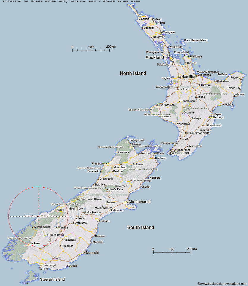
Topo Map showing location of Gorge River Hut
This information is sourced from DoC, LINZ and Openstreetmap. Some of the hut photos are mine and the rest are from DoC. I will be adding an upload feature soon so people can photos of .Gorge River Hut.
Basic info: standard six-bunk hut in the South Westland area.
Latitude: -44.1841541445
Longitude: 168.193819134
Location: Jackson Bay - Gorge River area
Area: West Coast
Type of Hut: Standard
Map: Topo Map | Road Map
Does this hut still exist? Have any more information? Contact
Basic info: standard six-bunk hut in the South Westland area.
Latitude: -44.1841541445
Longitude: 168.193819134
Location: Jackson Bay - Gorge River area
Area: West Coast
Type of Hut: Standard
Map: Topo Map | Road Map
Does this hut still exist? Have any more information? Contact
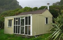
Image: DoC
Scroll down to see a topographical map and road map showing the location of Gorge River Hut
[ A ] [ B ] [ C ] [ D ] [ E ] [ F ] [ G ] [ H ] [ I ] [ J ] [ K ] [ L ] [ M ] [ N ] [ O ] [ P ] [ Q ] [ R ] [ S ] [ T ] [ U ] [ V ] [ W ] [ Y ] [ Z ]
Closest 20 Huts to Gorge River Hut
These are as the crow fliesSpoon Hut 9.59km Big Bay Hut 14.22km Martins Bay Hut 22.65km Hokuri Hut 28.52km Olivine Hut 28.91km Stafford Hut 34.99km Demon Trail Hut 35.78km McKerrow Island Hut 38.53km Kaipo Hut 39.26km Lake Alabaster Hut 40.42km Arawhata Rock Bivouac 41.69km Daleys Flat Hut 42.95km Colin Todd Hut 45.01km Liverpool Hut 46.5km Scotts Rock Bivouac 46.71km Dart Hut 47.23km Pawnbroker Rock 48.05km French Ridge Hut 48.19km Shelter Rock Hut 48.6km Hidden Falls Hut 49.27km Aspiring Hut 49.37km Sunshine Hut 49.86km Turners Bivouac 50.41km Esquilant Bivvy Hut 50.86km Cascade Hut 51.01km Earnslaw Hut 52.67km Rock of Ages Bivouac 54.1km Twenty Five Mile Hut 55.31km Top Forks Hut 56.46km Lochnagar Hut 56.92km Tummel Burn Hut 57.08km Raspberry Creek Shelter 57.23km Routeburn Shelter 59.84km Hundred Mile Hut 59.93km Routeburn Flats Hut 60.24km Routeburn Falls Hut 60.24km Sandfly Point Shelter 60.26km Routeburn Falls Lodge 60.28km Gill's Bivvy 62.52km Phil's Bivvy 63.23km