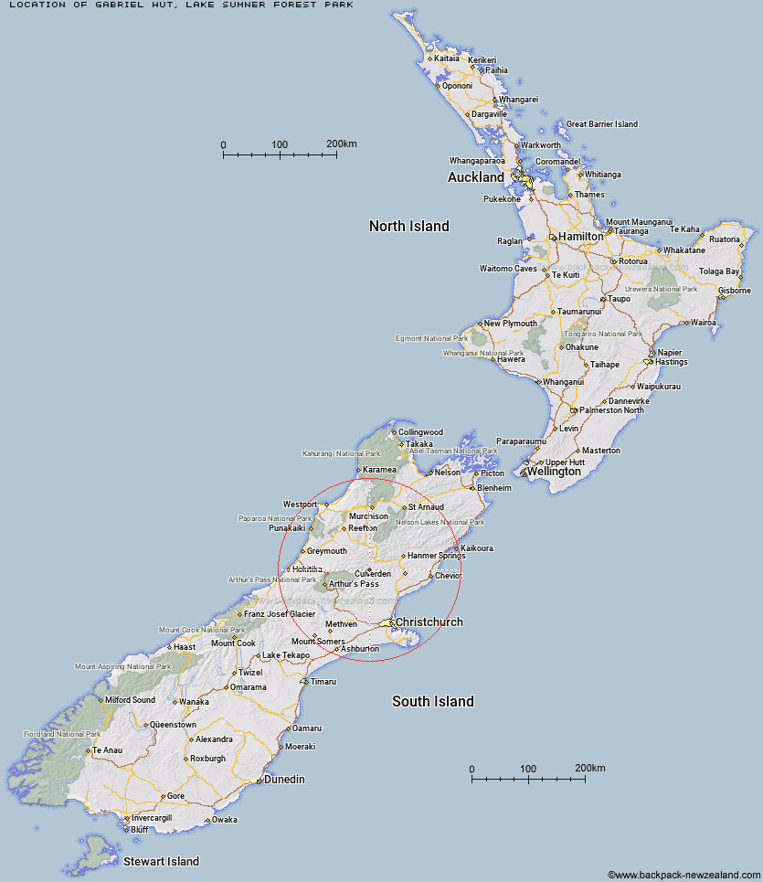
Topo Map showing location of Gabriel Hut
This information is sourced from DoC, LINZ and Openstreetmap. Some of the hut photos are mine and the rest are from DoC. I will be adding an upload feature soon so people can photos of .Gabriel Hut.
Basic info: basic four-bunk hut in the North Canterbury and Arthur's Pass area.
Latitude: -42.7212315289
Longitude: 172.289833589
Location: Lake Sumner Forest Park
Area: Canterbury
Type of Hut: Basic/bivvies
Map: BU23 Topo Map | Road Map
Does this hut still exist? Have any more information? Contact
Basic info: basic four-bunk hut in the North Canterbury and Arthur's Pass area.
Latitude: -42.7212315289
Longitude: 172.289833589
Location: Lake Sumner Forest Park
Area: Canterbury
Type of Hut: Basic/bivvies
Map: BU23 Topo Map | Road Map
Does this hut still exist? Have any more information? Contact
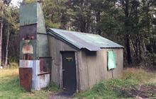
Image: DoC
Scroll down to see a topographical map and road map showing the location of Gabriel Hut
[ A ] [ B ] [ C ] [ D ] [ E ] [ F ] [ G ] [ H ] [ I ] [ J ] [ K ] [ L ] [ M ] [ N ] [ O ] [ P ] [ Q ] [ R ] [ S ] [ T ] [ U ] [ V ] [ W ] [ Y ] [ Z ]
Closest 20 Huts to Gabriel Hut
These are as the crow fliesJollie Brook Hut 3.6km Evangeline Bivouac 4.41km Cold Stream Hut 7.95km Lake Mason Hut 10.33km Museum Hut 10.44km Hope Halfway Hut 11.75km Lake Sumner Hut 11.76km Glenrae Hut 12.71km Glenrae Bivouac 12.83km Three Mile Stream Hut 13.09km Deep Creek Hut 13.59km Saint Jacob's Hut 13.65km Bush Camp Hut 14.46km Stony Stream Hut 15.46km Hurunui Hut 15.95km Bus Shelter 16.72km Top Hope Hut 17.35km South Branch Research Hut 17.36km Lake Man Bivouac 19.86km North Esk Hut 20.01km Mackenzie Bivouac 20.04km Esk Bivouac 20.14km Bush Hut 20.65km Seldom Inn Hut 20.74km Doubtful Hut 21.15km Valley Camp Hut 22.15km Ant Stream Bivouac 22.67km Doubtless Hut 22.75km Anderson's Hut 22.8km Mackenzie Hut 23.62km Hurunui No 3 Hut 24.76km Candlesticks Bivouac 24.81km Upper South Branch Hurunui Hut 25.17km Cattle Creek Hut 25.28km Carlyle Hut 25.4km Ant Stream Hut 25.5km Slaty Creek Hut 25.79km Devils Den Bivouac 25.96km Camerons Hut 27.61km Upper Nina Bivouac 28.02km