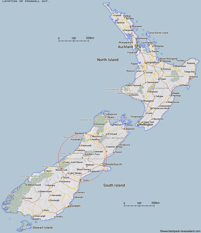
Topo Map showing location of Fanghill Hut
This information is sourced from DoC, LINZ and Openstreetmap. Some of the hut photos are mine and the rest are from DoC. I will be adding an upload feature soon so people can photos of .Fanghill Hut.
Latitude: -43.1277531112
Longitude: 171.370634721
Location:
Type of Hut:
Map: Topo Map | Road Map
Does this hut still exist? Have any more information? Contact
Latitude: -43.1277531112
Longitude: 171.370634721
Location:
Type of Hut:
Map: Topo Map | Road Map
Does this hut still exist? Have any more information? Contact
Scroll down to see a topographical map and road map showing the location of Fanghill Hut
[ A ] [ B ] [ C ] [ D ] [ E ] [ F ] [ G ] [ H ] [ I ] [ J ] [ K ] [ L ] [ M ] [ N ] [ O ] [ P ] [ Q ] [ R ] [ S ] [ T ] [ U ] [ V ] [ W ] [ Y ] [ Z ]
Closest 20 Huts to Fanghill Hut
These are as the crow fliesMoa Hut 4.47km Manuels Hut 5.26km Back Basin Hide 6.82km Weka Burnet Bivouac 8.71km Moa Stream Hut 8.93km Basins Hut 9.25km Old Basins Hut 9.42km Avoca Hut 9.6km Unknown Stream Hut 10.46km Urquhart's Hut 11.29km Barker Hut 15.59km Park Morpeth Hut 17.5km Canyon Creek Bivouac 17.67km Mungo Hut 18.05km Anti Crow Hut 18.27km Sir Robert Hut 19.11km Bealey Spur Hut 19.31km Moraine Hut 19.43km West Harper Hut 19.44km Carrington Hut 19.71km Toaroha Saddle Bivouac 20.32km Lagoon Saddle Hut 20.39km Lagoon Saddle A Frame Hut 20.43km Poet Hut 20.45km Mathias Hut 20.5km Centennial Cabin 20.82km Hamilton Hut 21.04km Crawford Junction Hut 21.65km Top Toaroha Hut 21.72km Bluff Hut 21.74km Top Kokatahi Hut 21.83km Klondyke Shelter 22.58km Top Crawford Hut 22.66km Crystal Bivouac 22.95km West Mathias Bivouac 23.2km Frew Saddle Bivouac 23.34km Harman Hut 23.49km Frisco Hut 23.65km Crow Hut 23.7km Greyneys Shelter 23.93km