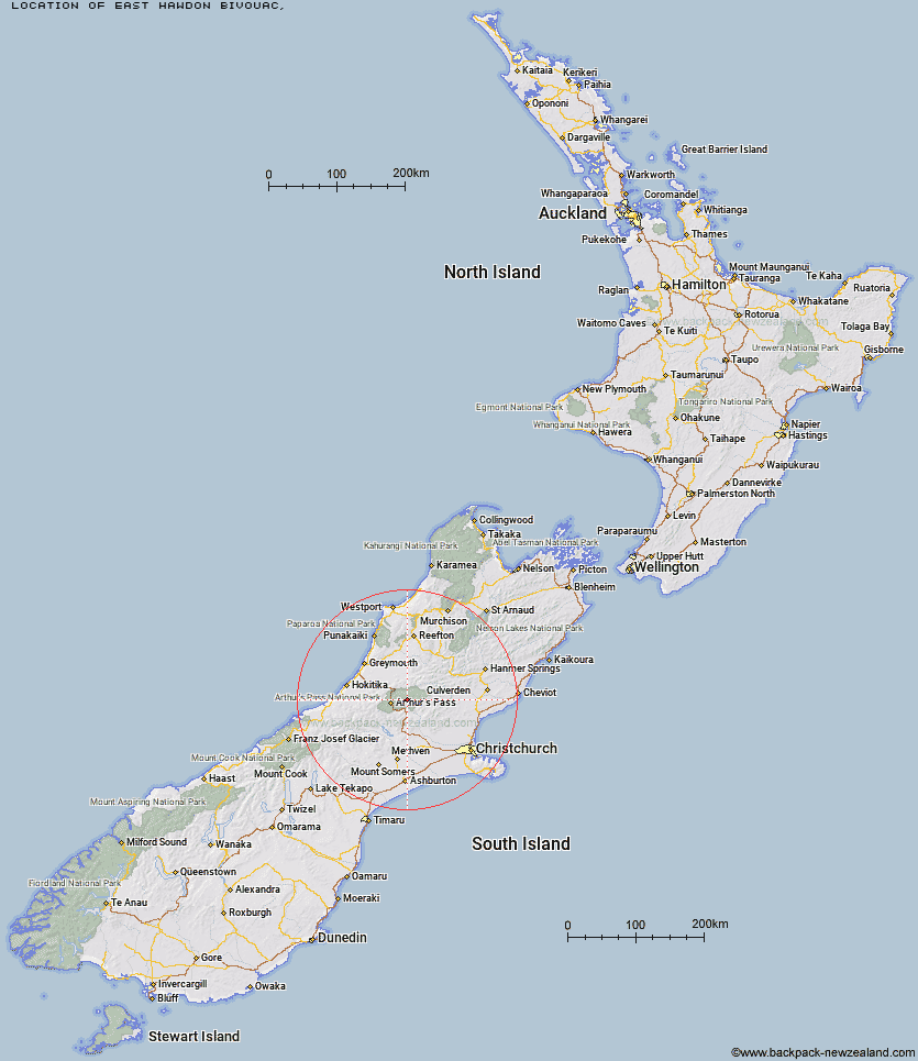
Topo Map showing location of East Hawdon Bivouac
This information is sourced from DoC, LINZ and Openstreetmap. Some of the hut photos are mine and the rest are from DoC. I will be adding an upload feature soon so people can photos of .East Hawdon Bivouac.
Latitude: -42.8999569249
Longitude: 171.776165257
Location:
Type of Hut:
Map: Topo Map | Road Map
Does this hut still exist? Have any more information? Contact
Latitude: -42.8999569249
Longitude: 171.776165257
Location:
Type of Hut:
Map: Topo Map | Road Map
Does this hut still exist? Have any more information? Contact
Scroll down to see a topographical map and road map showing the location of East Hawdon Bivouac
[ A ] [ B ] [ C ] [ D ] [ E ] [ F ] [ G ] [ H ] [ I ] [ J ] [ K ] [ L ] [ M ] [ N ] [ O ] [ P ] [ Q ] [ R ] [ S ] [ T ] [ U ] [ V ] [ W ] [ Y ] [ Z ]
Closest 20 Huts to East Hawdon Bivouac
These are as the crow fliesHawdon Hut 3.75km Worsley Bivouac 5.42km Poulter Hut 6.26km Otehake Hut 7.12km Trust/Poulter Hut 7.4km Sudden Valley Bivouac 8.03km Poulter Bivouac 9.43km Hawdon Shelter 10.03km Koropuku Hut 10.35km Andrews Shelter 10.55km Ranger Bivouac 10.97km Riversdale Hut 11.14km Edwards Hut 11.43km Minchin Bivouac 12.02km Mingha Bivouac 12.17km Goat Pass Hut 12.33km Turnbull Bivouac 12.45km Upper Deception Hut 13.08km Townsend Hut 13.98km Pfeifer Bivouac 14.04km Bull Creek Hut 15.67km Kiwi Hut 16.13km Greyneys Shelter 17.8km Jacks Hut 17.83km Locke Stream Hut 18.34km Bealey Hut 18.83km Klondyke Shelter 19km Lochinvar Hut 19.21km Crow Hut 21.65km Candlesticks Bivouac 21.66km Harper Pass Bivouac 21.79km Carroll Hut 21.95km Lagoon Saddle A Frame Hut 22.34km Lagoon Saddle Hut 22.35km Bealey Spur Hut 22.38km Top Trent / Lagoon Hut 22.74km Top Crooked Hut 22.83km Upper South Branch Hurunui Hut 22.91km Cass Saddle Hut 22.95km Hunts Creek Hut 23.32km