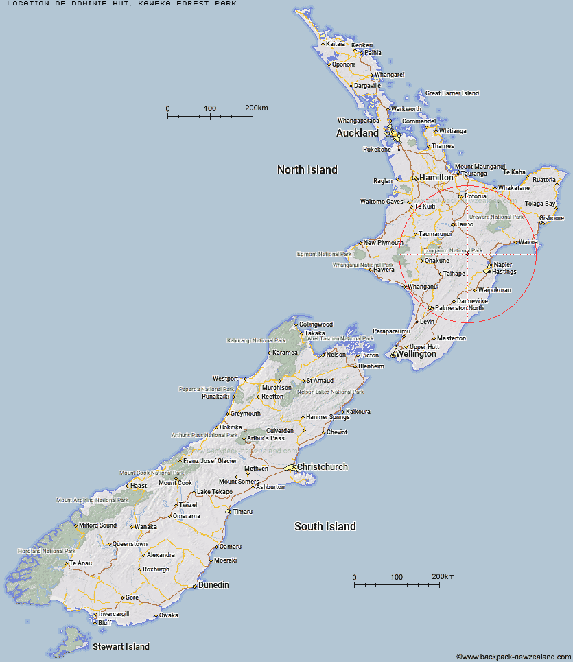
Topo Map showing location of Dominie Hut
This information is sourced from DoC, LINZ and Openstreetmap. Some of the hut photos are mine and the rest are from DoC. I will be adding an upload feature soon so people can photos of .Dominie Hut.
Basic info: Dominie Hut is located in the eastern Kaweka Forest Park, 80 minutes walk from the Makahu Saddle Hut and roadend.
Latitude: -39.2805094864
Longitude: 176.393943782
Location: Kaweka Forest Park
Area: Hawke's Bay
Type of Hut: Basic/bivvies
Map: BJ37 Topo Map | Road Map
Does this hut still exist? Have any more information? Contact
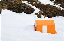
Image: DoC
Scroll down to see a topographical map and road map showing the location of Dominie Hut
[ A ] [ B ] [ C ] [ D ] [ E ] [ F ] [ G ] [ H ] [ I ] [ J ] [ K ] [ L ] [ M ] [ N ] [ O ] [ P ] [ Q ] [ R ] [ S ] [ T ] [ U ] [ V ] [ W ] [ Y ] [ Z ]
Closest 20 Huts to Dominie Hut
These are as the crow fliesMakahu Saddle Hut 1.38km Kaweka Flats Bivouac 2.83km Back Ridge Hut 3.25km Studholme Saddle Hut 3.42km Studholme Saddle Bivouac 3.81km Iron Whare 4.15km Black Birch Bivouac 4.49km Ballard Hut 5.16km Mackintosh Hut 5.43km Back Ridge Bivouac 5.47km Middle Hill Hut 6.55km Venison Tops Hut (Tira Lodge) 7.24km Rocks Ahead Hut 8.39km Rocks Ahead Bivouac 8.51km Kiwi Saddle Hut 8.57km Mangaturutu Hut 8.77km Manson Bivouac 9.25km Omarukokere Bivouac 9.42km Makino Hut 10.18km Kiwi Mouth Hut 11.05km Old Manson Hut 11.43km Manson Hut 11.66km Cameron Hut 12.58km Ngaawapurua Hut 13.5km Otutu Hut 13.88km Te Puke (Te Pukeohikarua) Hut 13.99km Lowry Shelter 14.35km Rock Camp Bivouac 15.2km Otutu Island Hut 15.55km Harkness Hut 16.34km Mangatainoka Hut 17.4km Lower Ripia Hut 17.86km Te Matai Hut 18.1km Tevers Hut 19.24km Upper Ripia Hut 19.27km Ernie's Creek Hut 19.88km Tussock Hut 20km Golden Hills Hut 21.52km Comet Hut 22.73km East Creek Hut 23.04km