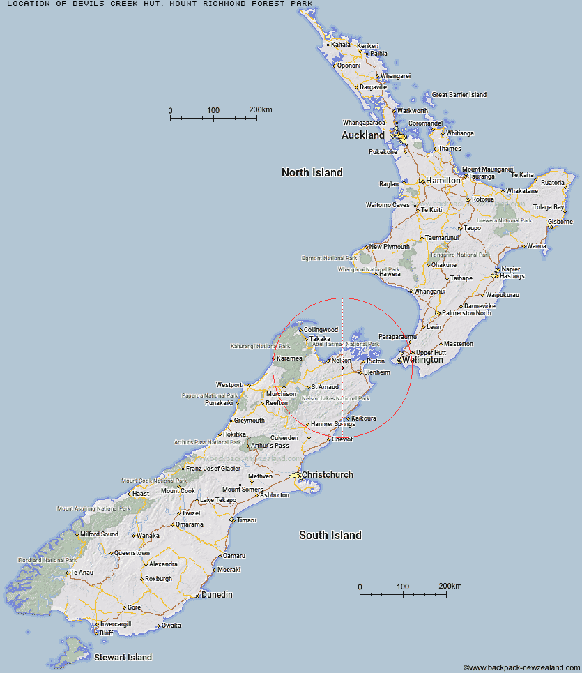
Topo Map showing location of Devils Creek Hut
This information is sourced from DoC, LINZ and Openstreetmap. Some of the hut photos are mine and the rest are from DoC. I will be adding an upload feature soon so people can photos of .Devils Creek Hut.
Basic info: Walk or mountain bike to Devils Creek Hut on the Wakamarina Track. At only 2 hours walk from the roadend it's a great place to escape.
Latitude: -41.4160423637
Longitude: 173.57711036
Location: Mount Richmond Forest Park
Area: Marlborough
Type of Hut: Standard
Tracks: Wakamarina Track|Quartz Creek/Mount Royal Route
Map: BQ27 Topo Map | Road Map
Does this hut still exist? Have any more information? Contact
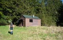
Image: DoC
Scroll down to see a topographical map and road map showing the location of Devils Creek Hut
[ A ] [ B ] [ C ] [ D ] [ E ] [ F ] [ G ] [ H ] [ I ] [ J ] [ K ] [ L ] [ M ] [ N ] [ O ] [ P ] [ Q ] [ R ] [ S ] [ T ] [ U ] [ V ] [ W ] [ Y ] [ Z ]
Closest 20 Huts to Devils Creek Hut
These are as the crow fliesFosters Hut 5.55km Fishtail Hut 8.04km Mt Sunday Bivouac 8.52km Chimney 9.25km Captain Creek Hut 12.73km Mt Fell Hut 14.3km Middy Creek Hut 15.79km Richmond Saddle Hut 17.39km Roebuck Hut 18.33km Dun Shelter 18.84km Rocks Hut 19.29km Third House Shelter 23.36km Browning Hut 25.05km Slaty Hut 26.06km Lake Chalice Hut 27.25km Hacket Hut 27.63km Old Man Hut 28.22km Starveall Hut 28.35km Ramshead Hut 30.57km McNaughts Hut 31.32km Mt Rintoul Hut 31.84km Beehive Hut 33.32km Mid Goulter Hut 33.82km Dillon Hut 34.75km Tinpot Hut 35.19km Omaka Bivouac 35.94km Tarn Hut 37.27km Lake Alexander Hut 37.73km Black Birch Bivouac 39.2km Lower Goulter Hut 39.91km Mid Wairoa Hut 41.67km Penk Hut 42.18km Turkeys Nest Bivouac 42.5km Hidden Hut 42.93km Gosling Hut 43.8km Top Wairoa Hut 47.05km Top Whare 49.16km Boulder Forks Hut 49.49km Hunters Hut 51.98km Blue Mountain Hut 53.94km