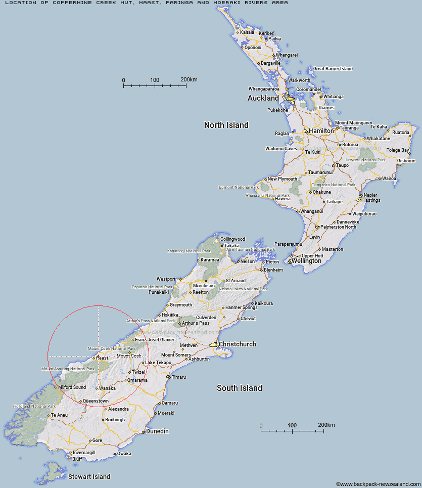
Topo Map showing location of Coppermine Creek Hut
This information is sourced from DoC, LINZ and Openstreetmap. Some of the hut photos are mine and the rest are from DoC. I will be adding an upload feature soon so people can photos of .Coppermine Creek Hut.
Basic info: standard eight-bunk hut in the South Westland area.
Latitude: -43.8223618346
Longitude: 169.167557188
Location: Haast, Paringa and Moeraki rivers area
Area: West Coast
Type of Hut: Standard
Tracks: Historic Haast to Paringa Cattle Track
Map: BY12 Topo Map | Road Map
Does this hut still exist? Have any more information? Contact
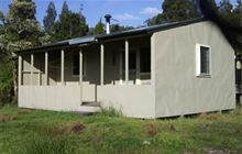
Image: DoC
Scroll down to see a topographical map and road map showing the location of Coppermine Creek Hut
[ A ] [ B ] [ C ] [ D ] [ E ] [ F ] [ G ] [ H ] [ I ] [ J ] [ K ] [ L ] [ M ] [ N ] [ O ] [ P ] [ Q ] [ R ] [ S ] [ T ] [ U ] [ V ] [ W ] [ Y ] [ Z ]
Closest 20 Huts to Coppermine Creek Hut
These are as the crow fliesThomas River Hut 8.24km Maori Saddle Hut 8.59km Blue River (Blowfly) Hut 14.68km Roaring Billy Hut 14.87km Red Hut 19.75km Horseshoe Flat Hut 19.82km Middle Head Hut 23.06km Franklin Hut 23.7km Tunnel Creek Hut 29.64km Wills Hut 33.66km Brewster Hut 35.43km Young Hut 39.66km Makarora Hut 40.52km Creswicke Flat Hut 43.27km Siberia Hut 43.35km Cameron Hut 43.54km Forbes Hut 44.1km Ferguson Hut 45.06km Kerin Forks Hut 47.53km Bull Flat Hut 47.66km Brodrick Hut 48.07km Scrubby Hut 48.3km Main Huxley Forks Hut 50.53km Top Hut 51.92km South Huxley Bivouac 52.28km Boundary Hut 52.31km Little Boundary Hut 52.84km Hagens Hut 52.9km Stafford Hut 53.48km Green Bush Hut 54.1km Elcho Hut 54.48km Cullers Hut 54.75km Big Hopwood Burn Hut 54.86km Top Forks Hut 54.9km Craigie Burn Hut 55.61km Cassel Flat Hut 56.01km Shamrock Hut 56.17km Monument Hut 56.27km Dasler Bivouac 56.37km Red Hut 56.86km