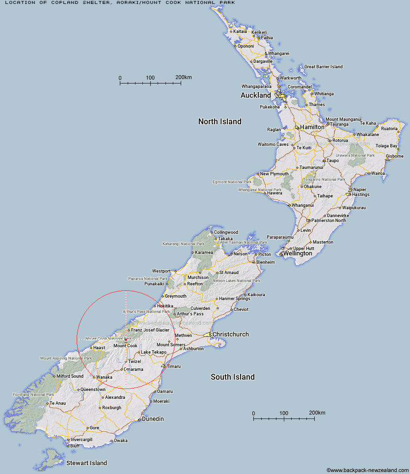
Topo Map showing location of Copland Shelter
This information is sourced from DoC, LINZ and Openstreetmap. Some of the hut photos are mine and the rest are from DoC. I will be adding an upload feature soon so people can photos of .Copland Shelter.
Basic info: basic four-bunk hut in the Aoraki/Mount Cook area.
Latitude: -43.6550710471
Longitude: 170.098577377
Location: Aoraki/Mount Cook National Park
Area: Canterbury
Type of Hut: Basic/bivvies
Map: BX15 Topo Map | Road Map
Does this hut still exist? Have any more information? Contact
Basic info: basic four-bunk hut in the Aoraki/Mount Cook area.
Latitude: -43.6550710471
Longitude: 170.098577377
Location: Aoraki/Mount Cook National Park
Area: Canterbury
Type of Hut: Basic/bivvies
Map: BX15 Topo Map | Road Map
Does this hut still exist? Have any more information? Contact
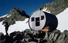
Image: DoC
Scroll down to see a topographical map and road map showing the location of Copland Shelter
[ A ] [ B ] [ C ] [ D ] [ E ] [ F ] [ G ] [ H ] [ I ] [ J ] [ K ] [ L ] [ M ] [ N ] [ O ] [ P ] [ Q ] [ R ] [ S ] [ T ] [ U ] [ V ] [ W ] [ Y ] [ Z ]
Closest 20 Huts to Copland Shelter
These are as the crow fliesSefton Bivvy 4.08km Stocking Stream Shelter 4.83km Caroline Hut 6.2km Douglas Rock Hut 6.43km Empress Hut 6.97km Mueller Hut 7.8km Ball Hut 8.15km Plateau Hut 10.51km Harpers Rock Bivouac 11.19km Haast Hut 11.27km Welcome Flat Campsite 12.53km Welcome Flat Hut 12.56km Barron Saddle Hut 13.99km Horace Walker Hut 14.67km Pioneer Hut 15.34km Chancellor Hut 16.11km Littles Hut 16.67km Christmas Flat Hut 16.82km Liebig Hut 17.31km Onslow Hut (Steffan Memorial Hut) 17.52km Architect Creek Hut 17.76km Reardon Hut 18.28km Green Point Hut 18.82km Lame Duck Hut 19.49km Centennial Hut 19.64km Waterfall Hut 21.69km Cassel Flat Hut 21.86km Almer Hut 21.94km Memorial Hut 23.12km Castle Rocks Hut 23.13km Jollie Hut 23.42km Birdcage Hut 23.57km Richardson Rock Bivouac 23.88km Tasman Saddle Hut 25.12km Hende's Hut 25.51km Tin Hut 25.8km Erceg Hut 25.91km Kelman Hut 25.98km Kennedy Hut 27.26km Ryders Hut 27.87km