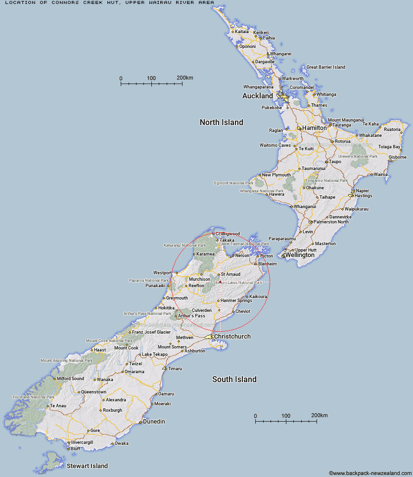
Topo Map showing location of Connors Creek Hut
This information is sourced from DoC, LINZ and Openstreetmap. Some of the hut photos are mine and the rest are from DoC. I will be adding an upload feature soon so people can photos of .Connors Creek Hut.
Basic info: standard 6-bunk hut in the Nelson Lakes area.
Latitude: -42.0053911398
Longitude: 172.885170443
Location: Upper Wairau River area
Area: Nelson/Tasman
Type of Hut: Standard
Map: BS25 Topo Map | Road Map
Does this hut still exist? Have any more information? Contact
Basic info: standard 6-bunk hut in the Nelson Lakes area.
Latitude: -42.0053911398
Longitude: 172.885170443
Location: Upper Wairau River area
Area: Nelson/Tasman
Type of Hut: Standard
Map: BS25 Topo Map | Road Map
Does this hut still exist? Have any more information? Contact
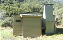
Image: DoC
Scroll down to see a topographical map and road map showing the location of Connors Creek Hut
[ A ] [ B ] [ C ] [ D ] [ E ] [ F ] [ G ] [ H ] [ I ] [ J ] [ K ] [ L ] [ M ] [ N ] [ O ] [ P ] [ Q ] [ R ] [ S ] [ T ] [ U ] [ V ] [ W ] [ Y ] [ Z ]
Closest 20 Huts to Connors Creek Hut
These are as the crow fliesBegley Hut 7.8km Lees Creek Hut 10.13km John Tait Hut 10.22km Upper Travers Hut 11.3km Cupola Hut 13.13km Branch Bivouac 13.39km Hopeless Hut 13.51km Severn Hut 14.01km Sedgemere Sleepout 14.52km Lakehead Hut 15.34km Paske Hut 16km Coldwater Hut 16.03km Top Misery Hut 16.22km Island Gully Hut 16.41km West Sabine Hut 16.62km Top Leatham Hut 16.66km Bottom Misery Hut 17.15km Angelus Hut 17.22km Lost Stream Bivouac 19.37km Mount Misery Hut 19.43km Bushline Hut 19.44km Red Gate Hut 19.78km Blue Lake Hut 19.89km Relax Shelter 19.96km Speargrass Hut 20.29km Bushedge Shelter 20.29km Sabine Hut 20.46km Siberia Hut 21.05km Morgan Hut 21.17km Bull Paddock Creek Hut 21.3km D'Urville Hut 22.66km Bottom Gordons Hut 22.75km Saxton Hut 22.75km Acheron Hut 22.97km Team Hut 23.49km George Lyon Hut 23.6km Mid Silverstream Hut 24.15km Caroline Creek Bivouac 24.83km Upper D'Urville Hut 25.76km Greigs Hut 26.15km