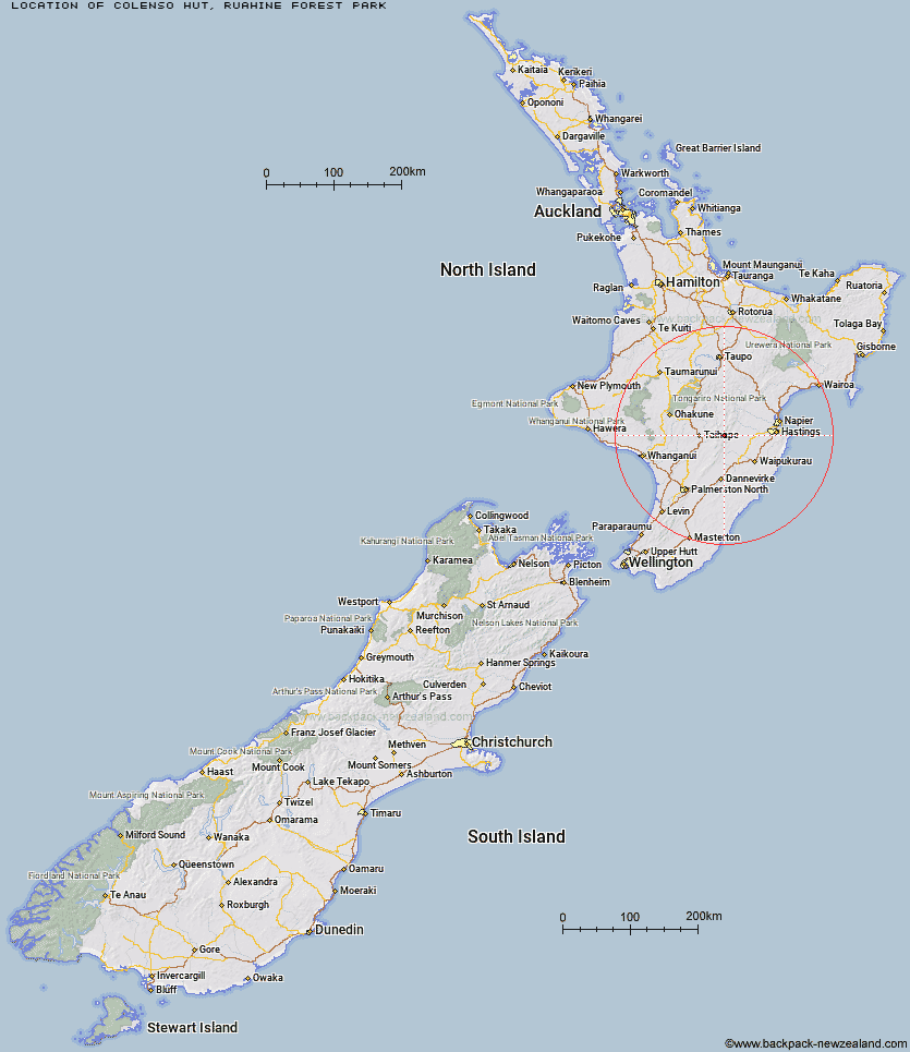
Topo Map showing location of Colenso Hut
This information is sourced from DoC, LINZ and Openstreetmap. Some of the hut photos are mine and the rest are from DoC. I will be adding an upload feature soon so people can photos of .Colenso Hut.
Basic info: standard eight-bunk hut in the Manawatu.
Latitude: -39.6715629627
Longitude: 176.140701686
Location: Ruahine Forest Park
Area: Manawatu/Whanganui
Type of Hut: Standard
Tracks: Ruahine Corner to Rangitane Road
Map: BK36 Topo Map | Road Map
Does this hut still exist? Have any more information? Contact
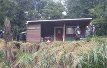
Image: DoC
Scroll down to see a topographical map and road map showing the location of Colenso Hut
[ A ] [ B ] [ C ] [ D ] [ E ] [ F ] [ G ] [ H ] [ I ] [ J ] [ K ] [ L ] [ M ] [ N ] [ O ] [ P ] [ Q ] [ R ] [ S ] [ T ] [ U ] [ V ] [ W ] [ Y ] [ Z ]
Closest 20 Huts to Colenso Hut
These are as the crow fliesColenso Hut 0km Iron Bark Hut 4.27km Kylie Bivouac 5.12km Ruahine Corner Hut 5.22km Otukota Hut 5.87km Maropea Forks Hut 6.48km Upper Makaroro Hut 7.57km Barlow Hut 7.76km Sparrowhawk Bivouac 8.09km Wakelings Hut 9.28km Parks Peak Hut 9.43km Rockslide Hut 9.6km Ikawetea Forks Hut 10.26km Aranga Hut 10.51km Gold Creek Hut 11.14km Mistake Bivouac 11.53km Top Maropea Hut 11.54km Crow Hut 11.62km Makirikiri Hut 11.94km Sentry Box Hut 12.02km McKinnon Hut 12.86km Kawhatau Base 12.93km Ellis Hut 12.94km Sunrise Hut 13.1km Norris Hut 13.68km No Mans Hut 14.26km Triplex Hut 14.41km Waipawa Forks Hut 14.45km Waikamaka Hut 15.58km Tin Hut 15.78km Poutaki Hut 16.14km Masters Shelter 16.2km Dead Dog Hut 16.99km Briens Hut 17.14km Waterfall Hut 17.65km Purity Hut 18.04km Taruarau Bivouac 18.14km Dianes Hut 18.86km Herricks Hut 19km Smiths Stream Hut 19.91km