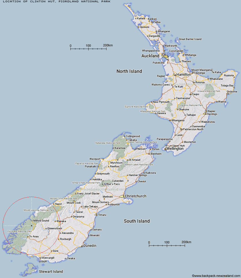
Topo Map showing location of Clinton Hut
This information is sourced from DoC, LINZ and Openstreetmap. Some of the hut photos are mine and the rest are from DoC. I will be adding an upload feature soon so people can photos of .Clinton Hut.
Basic info: 40-bunk, Great Walk hut on the Milford Track, Fiordland. Bookings required in the Great Walks season.
Latitude: -44.9058581047
Longitude: 167.908332979
Location: Fiordland National Park
Area: Fiordland
Type of Hut: Great Walk
Tracks: Milford Track
Map: CB09 Topo Map | Road Map
Does this hut still exist? Have any more information? Contact
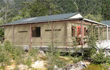
Image: DoC
Scroll down to see a topographical map and road map showing the location of Clinton Hut
[ A ] [ B ] [ C ] [ D ] [ E ] [ F ] [ G ] [ H ] [ I ] [ J ] [ K ] [ L ] [ M ] [ N ] [ O ] [ P ] [ Q ] [ R ] [ S ] [ T ] [ U ] [ V ] [ W ] [ Y ] [ Z ]
Closest 20 Huts to Clinton Hut
These are as the crow fliesGlade House 2.35km Hirere Shelter 6.66km Worsley Hut 7.17km Prairie Shelter 10.1km Bus Stop Shelter 10.99km Pompolona Lodge 11.37km Mintaro Hut 14.63km Mackinnon Pass Shelter 15.56km Andersons Cascade Shelter 16.35km Homer Hut 17.1km Quintin Lodge 17.64km The Divide Shelter 18.79km McKellar Lodge 19.01km McKellar Hut 19.03km Dumpling Hut 19.03km Glaisnock Hut 19.56km Boatshed Hut 20.47km Boatshed Shelter 20.49km Lake Howden Hut 20.52km Phil's Bivvy 20.94km Gill's Bivvy 21.48km Rats Nest Hut 22.3km Giant Gate Shelter 22.63km Steele Creek Hut 24.15km Sandfly Point Shelter 24.65km Steele Creek Lodge 24.82km Upper Caples Hut 25.67km Lake Mackenzie Lodge 25.87km Lake Mackenzie Hut 25.97km Mid Caples Hut 28.78km Forks Hut 28.84km Greenstone Hut 29.05km Kay Creek Hut 29.17km Home Hill Hut 29.23km Slip Flat Hut 29.34km Taipo Hut 29.48km Routeburn Falls Lodge 30.4km Routeburn Falls Hut 30.46km Lake Hankinson Hut 31.16km Routeburn Flats Hut 31.43km