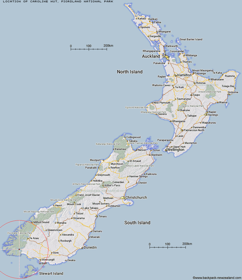
Topo Map showing location of Caroline Hut
This information is sourced from DoC, LINZ and Openstreetmap. Some of the hut photos are mine and the rest are from DoC. I will be adding an upload feature soon so people can photos of .Caroline Hut.
Basic info: basic six-bunk hut in southern Fiordland.
Latitude: -45.9413230454
Longitude: 167.283304824
Location: Fiordland National Park
Area: Fiordland
Type of Hut: Basic/bivvies
Map: CF07 Topo Map | Road Map
Does this hut still exist? Have any more information? Contact
Basic info: basic six-bunk hut in southern Fiordland.
Latitude: -45.9413230454
Longitude: 167.283304824
Location: Fiordland National Park
Area: Fiordland
Type of Hut: Basic/bivvies
Map: CF07 Topo Map | Road Map
Does this hut still exist? Have any more information? Contact
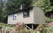
Image: DoC
Scroll down to see a topographical map and road map showing the location of Caroline Hut
[ A ] [ B ] [ C ] [ D ] [ E ] [ F ] [ G ] [ H ] [ I ] [ J ] [ K ] [ L ] [ M ] [ N ] [ O ] [ P ] [ Q ] [ R ] [ S ] [ T ] [ U ] [ V ] [ W ] [ Y ] [ Z ]
Closest 20 Huts to Caroline Hut
These are as the crow fliesEel Creek Hut 8.94km Monowai Hut 12.95km Teal Bay Hut 13.96km Rodger Inlet Huts 15.49km Hauroko Burn Hut 16.29km Clark Hut - A Frame 16.98km Historic Clark Hut 17.65km Green Lake Hut 19.54km Lake Poteriteri Hut 21.36km Halfway Hut 22.92km Borland Bivouac 23.41km Okaka Lodge 24.3km Lake Roe Hut 28.57km Port Craig Lodge 31.78km Port Craig School Hut 31.85km North Borland Hut 32.46km Slaughterburn Hut 32.54km Loch Maree Hut 33.13km Percy Burn Hut 33.41km Wairaurahiri Hut 35.13km Waitutu Hut 37.01km Supper Cove Hut 37.36km Kintail Hut 38.58km Percy Shelter 39.28km Westies Hut 40.42km Upper Spey Hut 41.21km Hope Arm Hut 43.91km Back Valley Hut 44.4km Barcoo Hut 45.4km West Arm Hut 46.26km Rock Hut 48.13km Telford Hut 48.39km Redcliff Hut 48.74km Te Oneroa Hut 51.27km Whare Creek Hut 51.91km Cheviot Downs Hut 51.95km Upper Wairaki Hut 52.25km Spence Hut 53.08km Lower Wairaki Hut 53.99km Shallow Bay Hut 55.98km