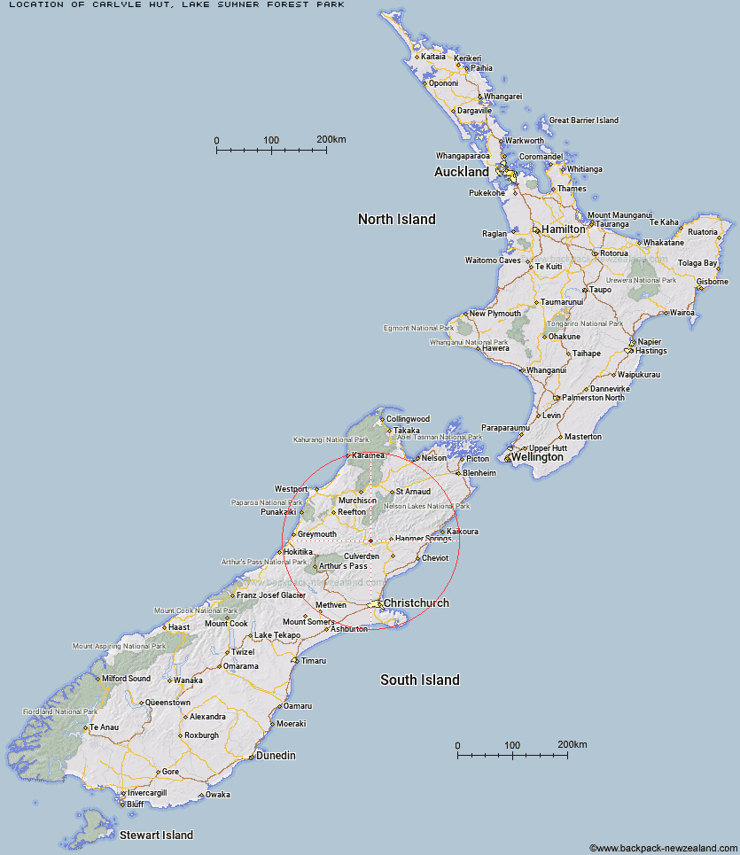
Topo Map showing location of Carlyle Hut
This information is sourced from DoC, LINZ and Openstreetmap. Some of the hut photos are mine and the rest are from DoC. I will be adding an upload feature soon so people can photos of .Carlyle Hut.
Basic info: basic eight-bunk hut in the North Canterbury area.
Latitude: -42.5503119922
Longitude: 172.495772475
Location: Lake Sumner Forest Park
Area: Canterbury
Type of Hut: Basic/bivvies
Map: BU23 Topo Map | Road Map
Does this hut still exist? Have any more information? Contact
Basic info: basic eight-bunk hut in the North Canterbury area.
Latitude: -42.5503119922
Longitude: 172.495772475
Location: Lake Sumner Forest Park
Area: Canterbury
Type of Hut: Basic/bivvies
Map: BU23 Topo Map | Road Map
Does this hut still exist? Have any more information? Contact
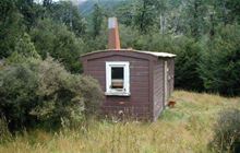
Image: DoC
Scroll down to see a topographical map and road map showing the location of Carlyle Hut
[ A ] [ B ] [ C ] [ D ] [ E ] [ F ] [ G ] [ H ] [ I ] [ J ] [ K ] [ L ] [ M ] [ N ] [ O ] [ P ] [ Q ] [ R ] [ S ] [ T ] [ U ] [ V ] [ W ] [ Y ] [ Z ]
Closest 20 Huts to Carlyle Hut
These are as the crow fliesMagdalen Hut 6.14km Tutu Hut 9.06km Boyle Flat Hut 9.86km Steyning Hut 10.35km Bus Shelter 10.45km Tin Jug Hut 11.39km Rokeby Hut 13.24km Stony Stream Bivouac 14.54km Valley Camp Hut 14.84km Jervois Hut 16.44km Glenrae Bivouac 16.64km Nina Hut 17.05km Doubtful Hut 17.54km Hope Halfway Hut 17.76km Scotties Hut 17.87km Devils Den Bivouac 17.91km Lucretia Hut 18.25km Bush Hut 19.46km Old Bridge Hut 19.62km Pool Hut 19.79km Upper Nina Bivouac 20.41km Brass Monkey Bivouac 20.71km Museum Hut 21.56km Anne Cullers Hut 21.74km Saint Jacob's Hut 22.1km Lake Man Bivouac 22.18km Anne Hut 22.31km Doubtless Hut 22.32km Evangeline Bivouac 23.05km Jollie Brook Hut 23.05km Lake Christabel Hut 23.39km Cold Stream Hut 23.45km Glenrae Hut 24.35km Gabriel Hut 25.4km Cannibal Gorge Hut 25.45km Top Hope Hut 26.59km Top Robinson Hut 27.15km Ada Pass Hut 27.51km Pell Stream Hut 28.21km Stanley Vale Hut 29.34km