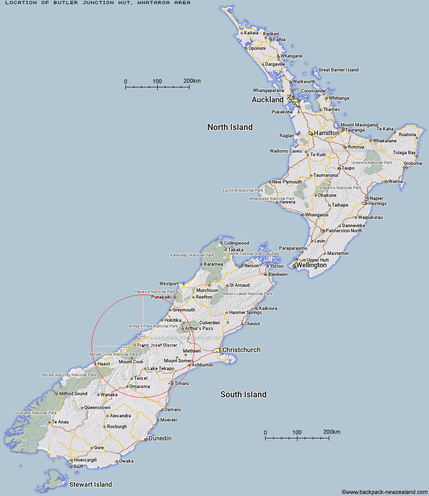
Topo Map showing location of Butler Junction Hut
This information is sourced from DoC, LINZ and Openstreetmap. Some of the hut photos are mine and the rest are from DoC. I will be adding an upload feature soon so people can photos of .Butler Junction Hut.
Basic info: standard eight-bunk hut in the Glaciers area.
Latitude: -43.4077149239
Longitude: 170.414345086
Location: Whataroa area
Area: West Coast
Type of Hut: Standard
Tracks: Whataroa, Butler and Perth valleys tracks
Map: BW16 Topo Map | Road Map
Does this hut still exist? Have any more information? Contact
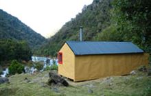
Image: DoC
Scroll down to see a topographical map and road map showing the location of Butler Junction Hut
[ A ] [ B ] [ C ] [ D ] [ E ] [ F ] [ G ] [ H ] [ I ] [ J ] [ K ] [ L ] [ M ] [ N ] [ O ] [ P ] [ Q ] [ R ] [ S ] [ T ] [ U ] [ V ] [ W ] [ Y ] [ Z ]
Closest 20 Huts to Butler Junction Hut
These are as the crow fliesTop Butler Hut 2.53km Whymper Hut 5.15km Stan's Hut 5.89km Nolans Hut 8.57km Godley Hut 11.2km Spencer Rock Bivouac 12.11km Murchison Hut 12.43km Scone Hut 13.01km Kelman Hut 13.13km Tasman Saddle Hut 13.17km Eade Memorial Hut 13.56km Red Stag Hut 16.35km Almer Hut 18.2km Centennial Hut 18.35km Hende's Hut 19.32km Forbes Bivouac 19.91km Castle Rocks Hut 20.6km Saint Winifreds Hut 21.73km Rankin Hut 22.2km Murphys Bivvy 22.26km Carneys Bivvy's 22.31km Mistake Flats Hut 23.01km Pioneer Hut 23.18km Onslow Hut (Steffan Memorial Hut) 24.05km Macaulay Hut 24.53km Curtis Memorial Hut 24.58km Liebig Hut 25.97km Haast Hut 26.22km Plateau Hut 26.98km Chancellor Hut 27.2km Angus Hut 27.87km Growler Hut 28.59km McCoy Hut 29.37km Ball Hut 30.12km Memorial Hut 30.12km Watchdog Hut 30.22km Birdcage Hut 30.53km Empress Hut 31.45km Caroline Hut 32.07km Stony Stream Hut 33.08km