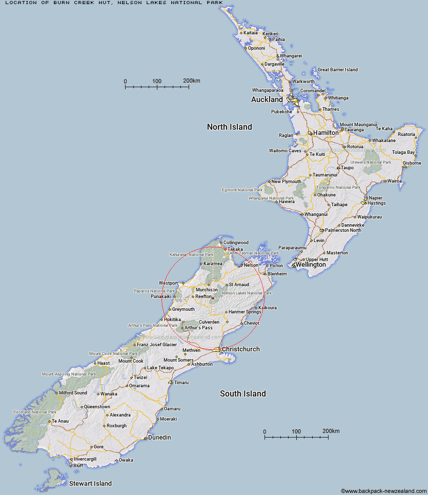
Topo Map showing location of Burn Creek Hut
This information is sourced from DoC, LINZ and Openstreetmap. Some of the hut photos are mine and the rest are from DoC. I will be adding an upload feature soon so people can photos of .Burn Creek Hut.
Basic info: basic 2-bunk hut in the Nelson Lakes area.
Latitude: -42.1566545655
Longitude: 172.449162433
Location: Nelson Lakes National Park
Area: Nelson/Tasman
Type of Hut: Basic/bivvies
Map: BT23 Topo Map | Road Map
Does this hut still exist? Have any more information? Contact
Basic info: basic 2-bunk hut in the Nelson Lakes area.
Latitude: -42.1566545655
Longitude: 172.449162433
Location: Nelson Lakes National Park
Area: Nelson/Tasman
Type of Hut: Basic/bivvies
Map: BT23 Topo Map | Road Map
Does this hut still exist? Have any more information? Contact
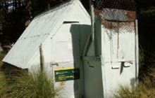
Image: DoC
Scroll down to see a topographical map and road map showing the location of Burn Creek Hut
[ A ] [ B ] [ C ] [ D ] [ E ] [ F ] [ G ] [ H ] [ I ] [ J ] [ K ] [ L ] [ M ] [ N ] [ O ] [ P ] [ Q ] [ R ] [ S ] [ T ] [ U ] [ V ] [ W ] [ Y ] [ Z ]
Closest 20 Huts to Burn Creek Hut
These are as the crow fliesDownie Hut 6.75km Nardoo Hut 6.82km Bobs Hut 8.06km East Matakitaki Hut 9.85km Upper D'Urville Hut 13.98km Ada Pass Hut 16.46km Christopher Cullers Hut 16.67km Matakitaki Base Hut 16.72km Caroline Creek Bivouac 17.39km Christopher Hut 17.49km George Lyon Hut 17.69km Cannibal Gorge Hut 18.97km Blue Lake Hut 20.21km Pell Stream Hut 20.83km Manson-Nicholls Memorial Hut 21.08km Lake Guyon Hut 21.9km Anne Hut 22.6km Anne Cullers Hut 22.78km Mole Hut 23.97km Morgan Hut 24.47km Stanley Vale Hut 24.83km West Sabine Hut 25.48km Paske Hut 25.66km Wheel Creek Hut 27.86km Lake Stream Hut 28.01km Top Waitahu Bivouac 28.6km Upper Travers Hut 29.08km Tiraumea Hut 29.75km Pool Hut 29.92km Old Bridge Hut 30.31km Jervois Hut 30.67km Mount Misery Hut 30.76km Rokeby Hut 30.83km Island Gully Hut 31.09km Cupola Hut 31.15km Lucretia Hut 31.19km Brass Monkey Bivouac 31.2km Fowlers Hut 31.3km Begley Hut 31.92km D'Urville Hut 32.32km