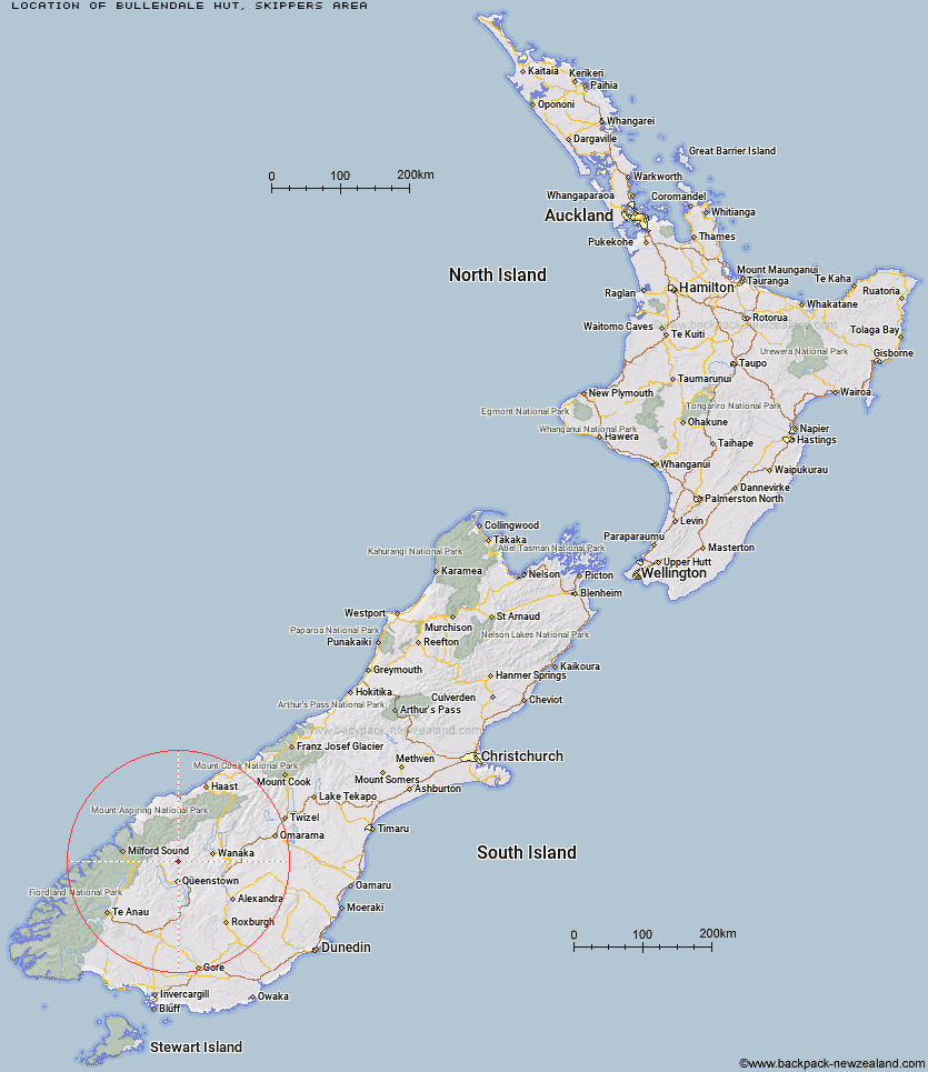
Topo Map showing location of Bullendale Hut
This information is sourced from DoC, LINZ and Openstreetmap. Some of the hut photos are mine and the rest are from DoC. I will be adding an upload feature soon so people can photos of .Bullendale Hut.
Basic info: standard four-bunk hut in the Queenstown/Wakatipu area.
Latitude: -44.787579301
Longitude: 168.673524276
Location: Skippers area
Area: Otago
Type of Hut: Standard
Tracks: Bullendale & Dynamo Hut Tracks
Map: CB11 Topo Map | Road Map
Does this hut still exist? Have any more information? Contact
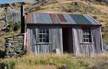
Image: DoC
Scroll down to see a topographical map and road map showing the location of Bullendale Hut
[ A ] [ B ] [ C ] [ D ] [ E ] [ F ] [ G ] [ H ] [ I ] [ J ] [ K ] [ L ] [ M ] [ N ] [ O ] [ P ] [ Q ] [ R ] [ S ] [ T ] [ U ] [ V ] [ W ] [ Y ] [ Z ]
Closest 20 Huts to Bullendale Hut
These are as the crow fliesDynamo Hut 1.76km Archie's Hut - Copper Creek 3.02km Ballarat Hut - Flood Burn 4.27km Crystal Hut 4.82km Peats Hut 5.99km Sainsburys Huts 7km Stoney Creek Hut 9.6km Green Gate Huts 12.45km Shiel Burn Hut 12.83km Sixteen Mile Huts 12.91km Cabin Hut 13.21km Roses Hut 15.04km Butchers Hut 16.08km Polnoon Hut 16.5km Wallers Hut 16.61km Eight Mile Hut 17.26km Kelly's Hut 17.5km McIntosh Hut 17.82km Heather Jock Hut 18.71km McIntyre's Hut 18.91km Bonnie Jean Hut 19.4km Jean Hut 19.4km Hundred Mile Hut 19.99km Highland Creek Hut 21.23km Lochnagar Hut 21.75km Twenty Five Mile Hut 22.9km Saddle Hut 23.76km Black Peak Hut 24.32km Tummel Burn Hut 24.35km Fern Burn Hut 25.11km Earnslaw Hut 25.67km Esquilant Bivvy Hut 28.46km Shelter Rock Hut 28.58km Sam Summers Hut 31km Dart Hut 31.03km Raspberry Creek Shelter 31.08km Routeburn Shelter 32.13km Cascade Hut 32.77km Meg Hut 33.39km Mid Caples Hut 33.63km