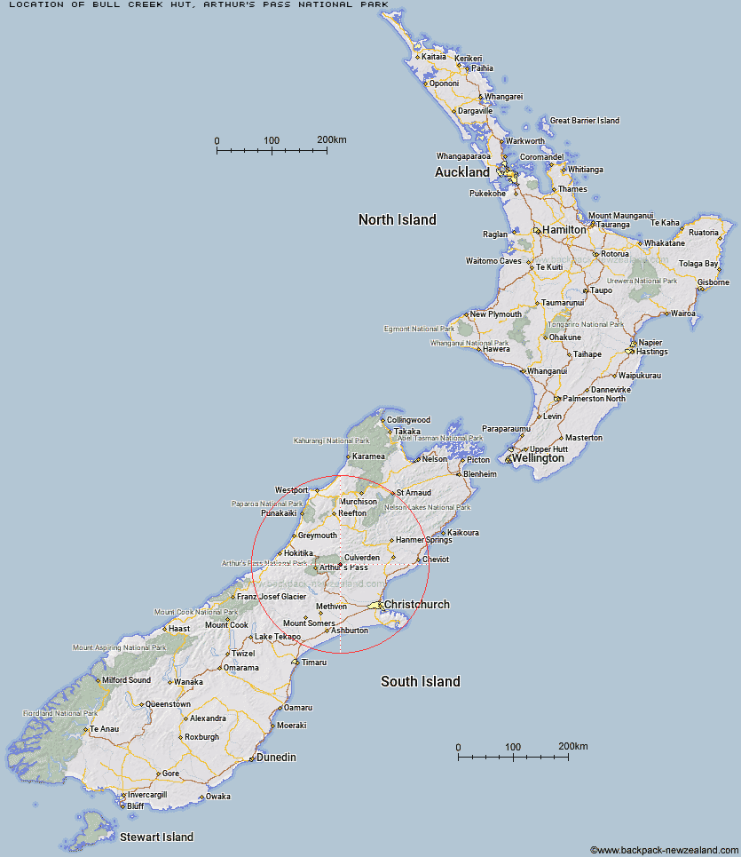
Topo Map showing location of Bull Creek Hut
This information is sourced from DoC, LINZ and Openstreetmap. Some of the hut photos are mine and the rest are from DoC. I will be adding an upload feature soon so people can photos of .Bull Creek Hut.
Basic info: basic four-bunk hut in the North Canterbury and Arthur's Pass area.
Latitude: -42.893126052
Longitude: 171.968329474
Location: Arthur's Pass National Park
Area: Canterbury
Type of Hut: Basic/bivvies
Map: BV21 Topo Map | Road Map
Does this hut still exist? Have any more information? Contact
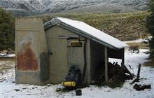
Image: DoC
Scroll down to see a topographical map and road map showing the location of Bull Creek Hut
[ A ] [ B ] [ C ] [ D ] [ E ] [ F ] [ G ] [ H ] [ I ] [ J ] [ K ] [ L ] [ M ] [ N ] [ O ] [ P ] [ Q ] [ R ] [ S ] [ T ] [ U ] [ V ] [ W ] [ Y ] [ Z ]
Closest 20 Huts to Bull Creek Hut
These are as the crow fliesLochinvar Hut 5.59km Ranger Bivouac 7.19km Candlesticks Bivouac 8.43km Turnbull Bivouac 8.53km Ant Stream Hut 9.84km Ant Stream Bivouac 10.8km Trust/Poulter Hut 11.09km Anna Hut 12.28km North Esk Hut 13.21km Poulter Hut 13.8km Upper South Branch Hurunui Hut 14.45km Anderson's Hut 15.37km East Hawdon Bivouac 15.67km Worsley Bivouac 15.79km Minchin Bivouac 16.91km Bush Camp Hut 18.15km Andrews Shelter 18.16km Poulter Bivouac 18.28km South Branch Research Hut 18.75km Stony Stream Hut 18.8km Hawdon Hut 19.3km Riversdale Hut 19.47km Harper Pass Bivouac 19.59km Cattle Creek Hut 19.7km Camerons Hut 20.32km Townsend Hut 20.41km Locke Stream Hut 20.43km Esk Bivouac 20.7km Deep Creek Hut 20.7km Hawdon Shelter 20.84km Koropuku Hut 21.08km Otehake Hut 21.36km Hurunui No 3 Hut 21.45km Tarn Hut 21.89km Sudden Valley Bivouac 22.38km Youngman Stream Hut 22.83km Mid Trent Hut 23.42km Hurunui Hut 23.5km Lake Mason Hut 23.52km Kiwi Hut 23.79km