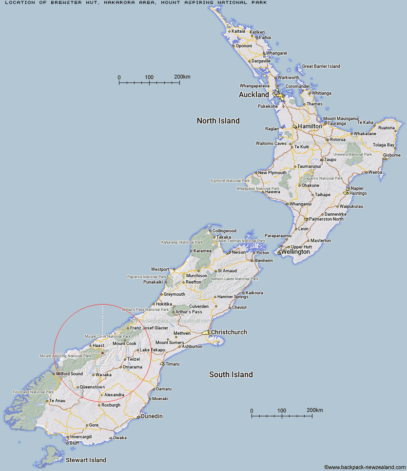
Topo Map showing location of Brewster Hut
This information is sourced from DoC, LINZ and Openstreetmap. Some of the hut photos are mine and the rest are from DoC. I will be adding an upload feature soon so people can photos of .Brewster Hut.
Basic info: serviced-alpine 12 bunk hut in the South Westland area.
Latitude: -44.0878171212
Longitude: 169.412269362
Location: Makarora area, Mount Aspiring National Park
Area: Otago
Type of Hut: Serviced Alpine
Tracks: Brewster Track
Map: BZ13 Topo Map | Road Map
Does this hut still exist? Have any more information? Contact
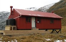
Image: DoC
Scroll down to see a topographical map and road map showing the location of Brewster Hut
[ A ] [ B ] [ C ] [ D ] [ E ] [ F ] [ G ] [ H ] [ I ] [ J ] [ K ] [ L ] [ M ] [ N ] [ O ] [ P ] [ Q ] [ R ] [ S ] [ T ] [ U ] [ V ] [ W ] [ Y ] [ Z ]
Closest 20 Huts to Brewster Hut
These are as the crow fliesBrewster Hut 0km Makarora Hut 5.14km Wills Hut 6.76km Ferguson Hut 11.58km Bull Flat Hut 12.71km Scrubby Hut 12.9km Cameron Hut 14.57km Forbes Hut 17.12km Boundary Hut 17.55km Little Boundary Hut 18.25km Green Bush Hut 19.39km Hagens Hut 19.64km Top Hut 20.54km Shamrock Hut 21.4km Roaring Billy Hut 22.56km High Burn Hut 23.6km Top Dingle Hut 24.31km Big Hopwood Burn Hut 24.91km Ahuriri Base Hut 25.34km Franklin Hut 26.2km South Huxley Bivouac 26.71km Young Hut 27.48km South Temple Hut 27.51km Thomas River Hut 27.71km Main Huxley Forks Hut 27.95km Brodrick Hut 28.25km Creswicke Flat Hut 28.73km Ben Avon Hut 29.38km Middle Head Hut 29.56km Maitland Hut 30.02km Siberia Hut 30.85km Horseshoe Flat Hut 30.95km Snowy Gorge Hut 31.45km Tunnel Creek Hut 31.57km Cotters Hut 31.64km Maori Saddle Hut 32.37km Monument Hut 32.72km Craigie Burn Hut 32.8km Blue River (Blowfly) Hut 33.25km Kerin Forks Hut 34.41km