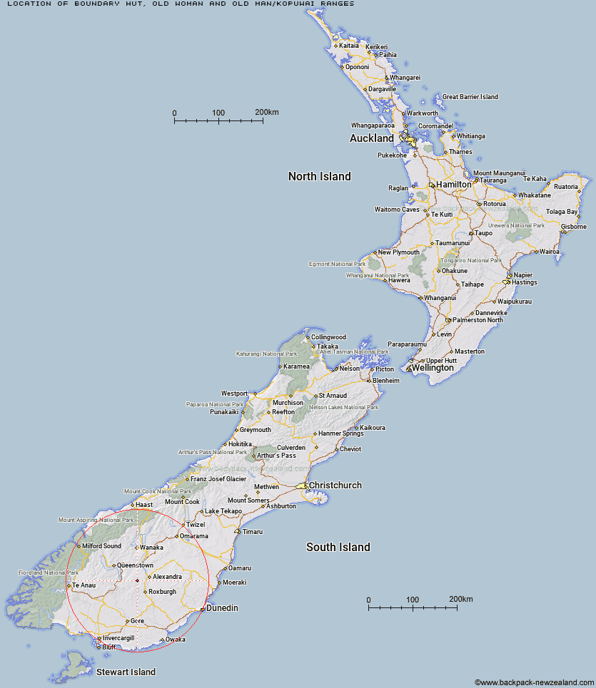
Topo Map showing location of Boundary Hut
This information is sourced from DoC, LINZ and Openstreetmap. Some of the hut photos are mine and the rest are from DoC. I will be adding an upload feature soon so people can photos of .Boundary Hut.
Basic info: A basic three-bunk hut in the Central Otago area.
Latitude: -45.3298979841
Longitude: 169.145175896
Location: Old Woman and Old Man/Kopuwai Ranges
Area: Otago
Type of Hut: Basic/bivvies
Map: CD12 Topo Map | Road Map
Does this hut still exist? Have any more information? Contact
Basic info: A basic three-bunk hut in the Central Otago area.
Latitude: -45.3298979841
Longitude: 169.145175896
Location: Old Woman and Old Man/Kopuwai Ranges
Area: Otago
Type of Hut: Basic/bivvies
Map: CD12 Topo Map | Road Map
Does this hut still exist? Have any more information? Contact
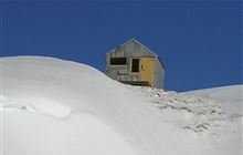
Image: DoC
Scroll down to see a topographical map and road map showing the location of Boundary Hut
[ A ] [ B ] [ C ] [ D ] [ E ] [ F ] [ G ] [ H ] [ I ] [ J ] [ K ] [ L ] [ M ] [ N ] [ O ] [ P ] [ Q ] [ R ] [ S ] [ T ] [ U ] [ V ] [ W ] [ Y ] [ Z ]
Closest 20 Huts to Boundary Hut
These are as the crow fliesNicholsons Hut 4.1km Diggers Hut 6.54km Whites Hut 7.35km McCrimmons Hut 8.51km Andrew Rees Hut 10.66km Potters Huts 10.79km Old Woman Hut 14.75km Christies Hut 18.61km Bush Huts 18.84km Baileys Hut 19.08km Junction Hut 20.33km Blue Lake Huts 23.2km Cairnmuir Musterer's Hut 25.53km Titan Huts 27.39km Two Mile Hut 31.9km Junction Hut 32.07km Black Hut 32.87km Flaxy Hut 33.41km Garston Ski Hut 33.94km Glen Roy Raceman's Hut 34.31km Slate Hut 34.52km Stronach Hut 34.94km Mud Hut 36.1km Dome Hut 36.61km Mitchells Hut 40.15km Deep Creek Hut 41.49km Hyde Home Hut 42.17km Ross Hut 42.83km Long Burn Hut 43.07km Siberia Hut 43.17km Jim Baird Hut 43.22km Sullivan Hut 44.38km Meg Hut 46.54km Leithen Hut 48.17km Billy Hut 51.03km Beaumont Hut 51.03km Kirtle Burn Hut 51.04km Saint Marys Hut 51.91km Robrosa Hut 52.69km Cowshed Hut 52.82km