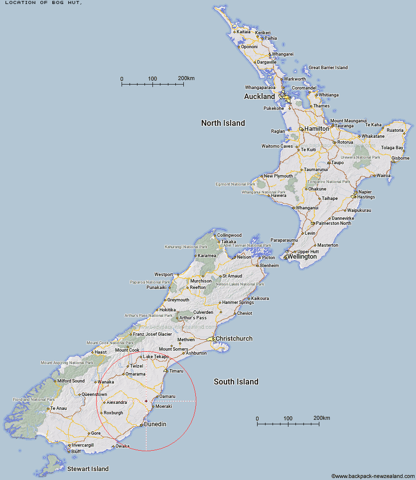
Topo Map showing location of Bog Hut
This information is sourced from DoC, LINZ and Openstreetmap. Some of the hut photos are mine and the rest are from DoC. I will be adding an upload feature soon so people can photos of .Bog Hut.
Latitude: -45.2121580424
Longitude: 170.633551094
Location:
Type of Hut:
Map: Topo Map | Road Map
Does this hut still exist? Have any more information? Contact
Latitude: -45.2121580424
Longitude: 170.633551094
Location:
Type of Hut:
Map: Topo Map | Road Map
Does this hut still exist? Have any more information? Contact
Scroll down to see a topographical map and road map showing the location of Bog Hut
[ A ] [ B ] [ C ] [ D ] [ E ] [ F ] [ G ] [ H ] [ I ] [ J ] [ K ] [ L ] [ M ] [ N ] [ O ] [ P ] [ Q ] [ R ] [ S ] [ T ] [ U ] [ V ] [ W ] [ Y ] [ Z ]
Closest 20 Huts to Bog Hut
These are as the crow fliesRed Hut 5.09km Mount Hut 6.99km Gentle Annie Hut 7.43km Cayenne Hut 7.51km Grays Hut 8.47km Mitchells Hut 9.18km Staircase Hut 9.73km Half Moon Hut 13.02km Middle Hut 17.04km Crumb Hut 19.35km Balmoral Huts 22.57km Buster Hut 43.42km Brown Hut 46.2km Leaning Lodge 48.54km Tailings Hut 50.18km Big Hut 50.23km Hut Creek Hut 50.48km Waitaki Huts 50.79km Bendoran Hut 52.36km Awakino Ski Field 54.62km Ida Railway Hut 55.11km Chimney Creek Hut 56.26km Philip J Cox Memorial Hut 56.54km Christmas Creek Hut 57.06km Wire Yards Hut 57.22km Jubilee Hut 58.34km Mt John Hut 58.83km Possum Hut 60.78km Poplar Hut 63.23km Howells Hut 64.94km Ben Rudds Hut 69.59km Pearson Hut 69.64km The Swamp Hut 73.94km Canadian Hut 74.12km Tent Hut 78.48km Otamatapaio Hut 78.5km Boundary Creek Hut 81.5km Lauder Basin Hut 86.7km Top Hut 88.28km Richmond Hut 89.54km