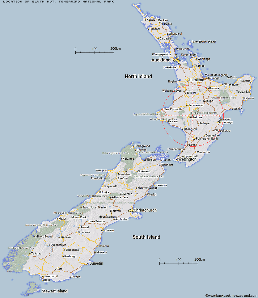
Topo Map showing location of Blyth Hut
This information is sourced from DoC, LINZ and Openstreetmap. Some of the hut photos are mine and the rest are from DoC. I will be adding an upload feature soon so people can photos of .Blyth Hut.
Basic info: serviced 20-bunk hut in the Ruapehu area.
Latitude: -39.3317959083
Longitude: 175.525054793
Location: Tongariro National Park
Area: Central North Island
Type of Hut: Serviced
Tracks: Round the Mountain Track
Map: BJ34 Topo Map | Road Map
Does this hut still exist? Have any more information? Contact
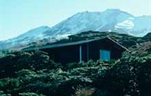
Image: DoC
Scroll down to see a topographical map and road map showing the location of Blyth Hut
[ A ] [ B ] [ C ] [ D ] [ E ] [ F ] [ G ] [ H ] [ I ] [ J ] [ K ] [ L ] [ M ] [ N ] [ O ] [ P ] [ Q ] [ R ] [ S ] [ T ] [ U ] [ V ] [ W ] [ Y ] [ Z ]
Closest 20 Huts to Blyth Hut
These are as the crow fliesLupton Hut 0.27km Mangaehuehu Hut 2.49km Mangaturuturu Hut 4.36km Whangaehu Hut 7.74km Rangipo Hut 9.2km Whakapapaiti Hut 10.48km Old Waihohonu Hut 18.62km Waihohonu Hut 19.04km Mangatepopo Hut 21.7km Oturere Hut 23.88km Ketetahi Shelter 27.22km Zekes Hut 30.05km Westlawn Hut 31.5km Ten Man Hut 35.67km Bob's Hut 39.57km Waipakihi Hut 43.89km Tieke Kainga 45.75km Puketotara Hut 47.21km Te Apunga Hut 49.08km Ohuraiti Hut 52km Ngapurua Hut 53.2km John Coull Hut 53.76km Downes hut 55.36km Golden Hills Hut 55.77km WTFRW Hut 56.72km Pouri Hut 57.96km Cedars Hut (Blowfly) 58.44km Cascade Hut 59.12km Otutu Island Hut 59.67km Rock Camp Bivouac 60.98km Otutu Hut 61.26km Tussock Hut 62.25km Iron Bark Hut 62.33km Makirikiri Hut 62.35km Ngaawapurua Hut 63.25km Harkness Hut 63.32km Manson Hut 63.35km Puteore Hut 63.37km Otukota Hut 63.45km Old Manson Hut 63.59km