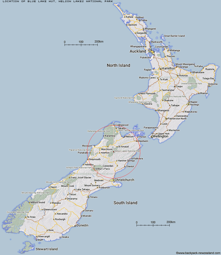
Topo Map showing location of Blue Lake Hut
This information is sourced from DoC, LINZ and Openstreetmap. Some of the hut photos are mine and the rest are from DoC. I will be adding an upload feature soon so people can photos of .Blue Lake Hut.
Basic info: serviced 16-bunk hut in the Nelson Lakes area.
Latitude: -42.0582649991
Longitude: 172.655120243
Location: Nelson Lakes National Park
Area: Nelson/Tasman
Type of Hut: Serviced
Tracks: Travers-Sabine Circuit
Map: BS24 Topo Map | Road Map
Does this hut still exist? Have any more information? Contact
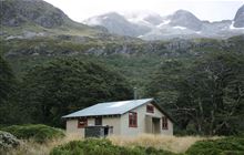
Image: DoC
Scroll down to see a topographical map and road map showing the location of Blue Lake Hut
[ A ] [ B ] [ C ] [ D ] [ E ] [ F ] [ G ] [ H ] [ I ] [ J ] [ K ] [ L ] [ M ] [ N ] [ O ] [ P ] [ Q ] [ R ] [ S ] [ T ] [ U ] [ V ] [ W ] [ Y ] [ Z ]
Closest 20 Huts to Blue Lake Hut
These are as the crow fliesGeorge Lyon Hut 4.3km West Sabine Hut 6.08km Upper D'Urville Hut 6.9km Morgan Hut 8.64km Upper Travers Hut 8.89km Paske Hut 10.11km Caroline Creek Bivouac 10.61km Cupola Hut 11.55km Matakitaki Base Hut 12.16km Begley Hut 12.19km Mole Hut 12.78km John Tait Hut 13.2km Downie Hut 13.61km Mount Misery Hut 13.86km Hopeless Hut 16.5km D'Urville Hut 16.99km East Matakitaki Hut 17.05km Island Gully Hut 17.17km Sabine Hut 17.61km Tiraumea Hut 17.79km Nardoo Hut 19.05km Connors Creek Hut 19.89km Burn Creek Hut 20.21km Angelus Hut 20.41km Sedgemere Sleepout 21.94km Bobs Hut 23.08km Speargrass Hut 24.3km Lakehead Hut 24.55km Coldwater Hut 24.81km Lake Guyon Hut 25.45km Christopher Cullers Hut 26.26km Christopher Hut 26.65km Relax Shelter 27.9km Bushline Hut 28.28km Bushedge Shelter 28.31km Stanley Vale Hut 28.67km Lees Creek Hut 29.35km Fowlers Hut 29.77km Severn Hut 31.51km Ada Pass Hut 31.87km