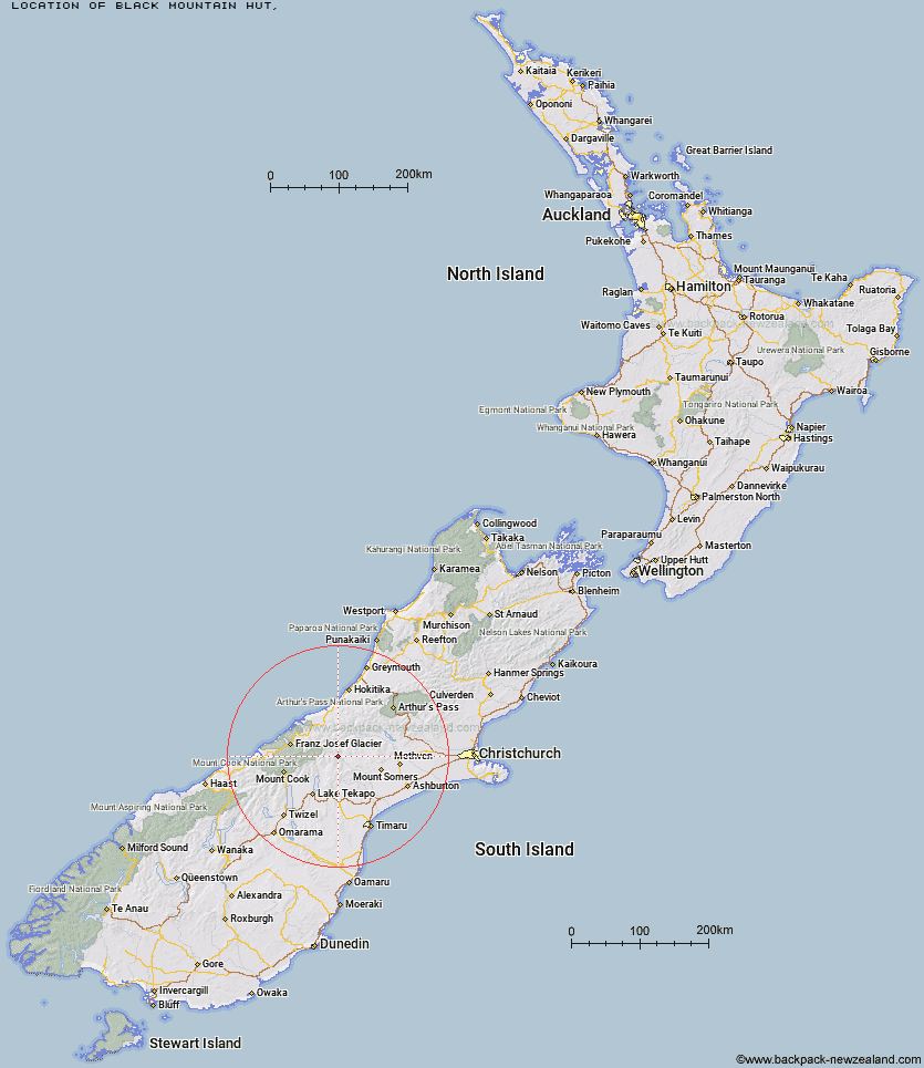
Topo Map showing location of Black Mountain Hut
This information is sourced from DoC, LINZ and Openstreetmap. Some of the hut photos are mine and the rest are from DoC. I will be adding an upload feature soon so people can photos of .Black Mountain Hut.
Latitude: -43.540109765
Longitude: 170.82117679
Location:
Type of Hut:
Map: Topo Map | Road Map
Does this hut still exist? Have any more information? Contact
Latitude: -43.540109765
Longitude: 170.82117679
Location:
Type of Hut:
Map: Topo Map | Road Map
Does this hut still exist? Have any more information? Contact
Scroll down to see a topographical map and road map showing the location of Black Mountain Hut
[ A ] [ B ] [ C ] [ D ] [ E ] [ F ] [ G ] [ H ] [ I ] [ J ] [ K ] [ L ] [ M ] [ N ] [ O ] [ P ] [ Q ] [ R ] [ S ] [ T ] [ U ] [ V ] [ W ] [ Y ] [ Z ]
Closest 20 Huts to Black Mountain Hut
These are as the crow fliesDog Kennel Bivouac 4.95km Growler Hut 7.4km Crooked Spur Hut 9.66km Erewhon Station Hut 10.56km Curtis Memorial Hut 13.12km Potts Hut 13.24km Carneys Bivvy's 13.7km Murphys Bivvy 14.12km Lawrence Hut 14.19km Mistake Flats Hut 14.49km Watchdog Hut 14.91km Forbes Bivouac 16.28km Stone Hut 16.75km Hermitage Hut 16.92km Saint Winifreds Hut 17.64km Macaulay Hut 18.11km McCoy Hut 18.36km Boundary Creek Hut 20.21km Felt Hut 20.94km Top Hut 21.37km Stony Stream Hut 21.81km Royal Hut 21.81km Lawrence Bivouac 22.65km Highland Home 24.6km Cameron Hut 24.95km Red Stag Hut 25.69km Godley Hut 25.93km Scone Hut 27.34km Eade Memorial Hut 27.45km Taffy Hut 27.59km Lyell Hut 27.73km Rankin Hut 28.68km Rex Simpson Hut 29.61km Angus Hut 30.67km Reischek Hut 31.16km Ribbonwood Hut 31.26km Camp Stream Hut 31.42km Spurs Hut 32.13km Lauper Bivouac 32.36km Banfield Hut 32.89km