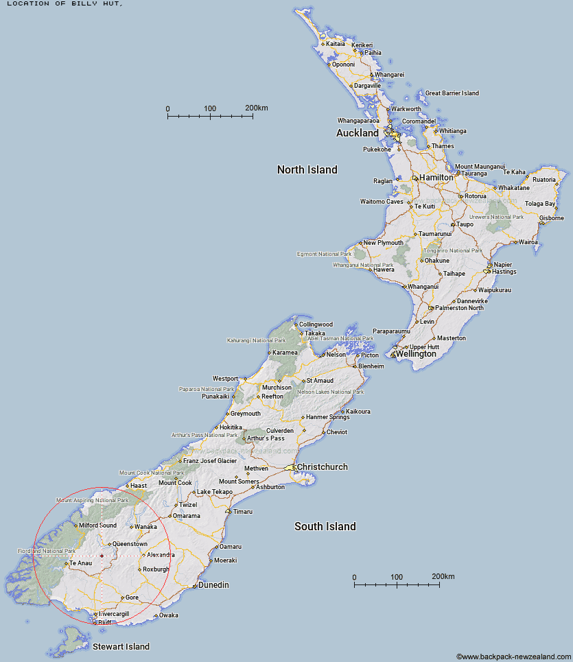
Topo Map showing location of Billy Hut
This information is sourced from DoC, LINZ and Openstreetmap. Some of the hut photos are mine and the rest are from DoC. I will be adding an upload feature soon so people can photos of .Billy Hut.
Latitude: -45.2659941175
Longitude: 168.499097674
Location:
Type of Hut:
Map: Topo Map | Road Map
Does this hut still exist? Have any more information? Contact
Latitude: -45.2659941175
Longitude: 168.499097674
Location:
Type of Hut:
Map: Topo Map | Road Map
Does this hut still exist? Have any more information? Contact
Scroll down to see a topographical map and road map showing the location of Billy Hut
[ A ] [ B ] [ C ] [ D ] [ E ] [ F ] [ G ] [ H ] [ I ] [ J ] [ K ] [ L ] [ M ] [ N ] [ O ] [ P ] [ Q ] [ R ] [ S ] [ T ] [ U ] [ V ] [ W ] [ Y ] [ Z ]
Closest 20 Huts to Billy Hut
These are as the crow fliesSaint Marys Hut 3.14km Ross Hut 8.41km Siberia Hut 8.46km Mitchells Hut 11.82km Cowshed Hut 11.94km Dog Box Bivouac 13.43km Long Burn Hut 14.53km Shepherd Creek Hut 16.24km Irthing Hut 21.24km Ashton Hut 22.32km Upper Cromel Hut 24.07km Sam Summers Hut 24.41km Upper Oreti Hut 25.13km Cromel Branch Hut 25.49km Two Mile Hut 25.86km Mansion Hut 26.65km Lincoln Hut 27.27km Upper Windley Hut 27.54km Careys Hut 27.59km West Burn Hut 27.82km Islands Hut 27.82km Garston Ski Hut 28.55km Boundary Hut 28.7km Slate Hut 30.03km Mt Bee Bunkrooms 30.48km Mud Hut 30.66km Baileys Hut 31.96km Cromel Base Hut 32.31km Taipo Hut 32.33km Kiwi Burn Hut 33.42km Forks Hut 33.68km Glen Roy Raceman's Hut 35.66km Lower Windley Hut 35.74km Army Hut 36.83km Greenstone Hut 36.89km Oreti Hut 37.7km Slip Flat Hut 38.69km Butchers Hut 38.86km Dome Hut 39.56km Steele Creek Lodge 40.57km