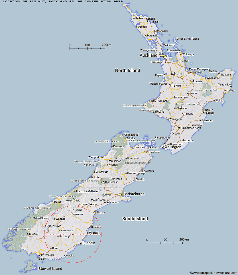
Topo Map showing location of Big Hut
This information is sourced from DoC, LINZ and Openstreetmap. Some of the hut photos are mine and the rest are from DoC. I will be adding an upload feature soon so people can photos of .Big Hut.
Basic info: This historic alpine hut in the Coastal Otago area is owned and managed by the Rock and Pillar Hut Trust.
Latitude: -45.4358250174
Longitude: 170.075327716
Location: Rock and Pillar Conservation Area
Area: Otago
Type of Hut:
Map: CD15 Topo Map | Road Map
Does this hut still exist? Have any more information? Contact
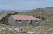
Image: DoC
Scroll down to see a topographical map and road map showing the location of Big Hut
[ A ] [ B ] [ C ] [ D ] [ E ] [ F ] [ G ] [ H ] [ I ] [ J ] [ K ] [ L ] [ M ] [ N ] [ O ] [ P ] [ Q ] [ R ] [ S ] [ T ] [ U ] [ V ] [ W ] [ Y ] [ Z ]
Closest 20 Huts to Big Hut
These are as the crow fliesLeaning Lodge 2.05km Howells Hut 15.17km The Swamp Hut 23.99km Canadian Hut 24.11km Tent Hut 30.82km Bendoran Hut 39.16km Mt John Hut 40.69km Christmas Creek Hut 41km Poplar Hut 42.34km Jubilee Hut 42.41km Gentle Annie Hut 43.63km Philip J Cox Memorial Hut 44.93km Cayenne Hut 44.98km Possum Hut 46.83km Half Moon Hut 46.96km Crumb Hut 47.21km Grays Hut 47.34km Mitchells Hut 47.71km Staircase Hut 49.84km Red Hut 49.93km Bog Hut 50.23km Iron Hut 50.97km Mount Hut 52.63km Ben Rudds Hut 52.88km Middle Hut 53.66km Balmoral Huts 58.83km Buster Hut 59.02km Brown Hut 62.65km Wire Yards Hut 65.27km Ida Railway Hut 65.68km Tailings Hut 65.78km Hut Creek Hut 68.89km Chimney Creek Hut 69.55km Junction Hut 69.99km Nicholsons Hut 70.04km Potters Huts 72.65km Andrew Rees Hut 73.07km Lauder Basin Hut 73.29km Boundary Hut 73.59km Cairnmuir Musterer's Hut 74.67km