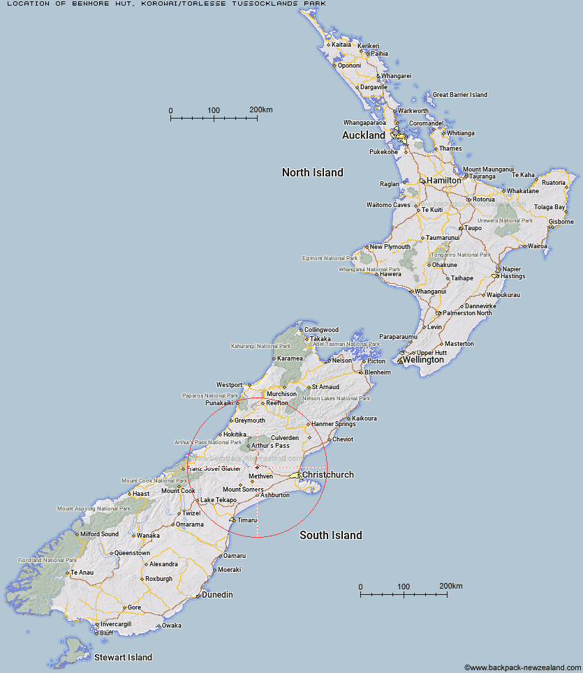
Topo Map showing location of Benmore Hut
This information is sourced from DoC, LINZ and Openstreetmap. Some of the hut photos are mine and the rest are from DoC. I will be adding an upload feature soon so people can photos of .Benmore Hut.
Basic info: basic four-bunk hut in the North Canterbury and Arthur's Pass area.
Latitude: -43.3689914748
Longitude: 171.756471996
Location: Korowai/Torlesse Tussocklands Park
Area: Canterbury
Type of Hut: Basic/bivvies
Map: BW21 Topo Map | Road Map
Does this hut still exist? Have any more information? Contact
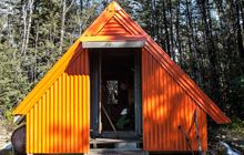
Image: DoC
Scroll down to see a topographical map and road map showing the location of Benmore Hut
[ A ] [ B ] [ C ] [ D ] [ E ] [ F ] [ G ] [ H ] [ I ] [ J ] [ K ] [ L ] [ M ] [ N ] [ O ] [ P ] [ Q ] [ R ] [ S ] [ T ] [ U ] [ V ] [ W ] [ Y ] [ Z ]
Closest 20 Huts to Benmore Hut
These are as the crow fliesBroken River Hut 20.95km Kinnebrooks Hut 22.6km Petticoat Junction Hut 22.93km Walker Hut 25.05km Rosa Hut 25.15km Tribulation Hut 25.87km Cookies Hut 28.48km Hamilton Hut 28.55km Black Hill Hut 29.22km Lower Salmon Creek Bivouac 29.33km Wharfedale Hut 29.85km Cutty Grass Hut 30.68km Cass Saddle Hut 30.69km A Frame Hut 31.25km Adams Hut 31.78km Lagoon Hut 31.8km Comyns Hut 32.15km West Harper Hut 32.29km Alford Hut 32.4km Hamilton Hut 32.65km Puketeraki Bivouac 33.53km Cookshop Hut 34.29km Lagoon Saddle A Frame Hut 37.08km Lagoon Saddle Hut 37.14km Basins Hut 37.3km Old Basins Hut 37.37km Bealey Hut 37.99km Three Creeks Hut 38.16km Manuels Hut 38.42km Bealey Spur Hut 40.3km Pinnacles Hut 40.35km Back Basin Hide 40.84km Riversdale Hut 41.05km Fanghill Hut 41.18km Andrews Shelter 41.8km Hawdon Shelter 42.41km Double Hut 42.43km Klondyke Shelter 42.97km Woolshed Creek Hut 43.29km Avoca Hut 43.96km