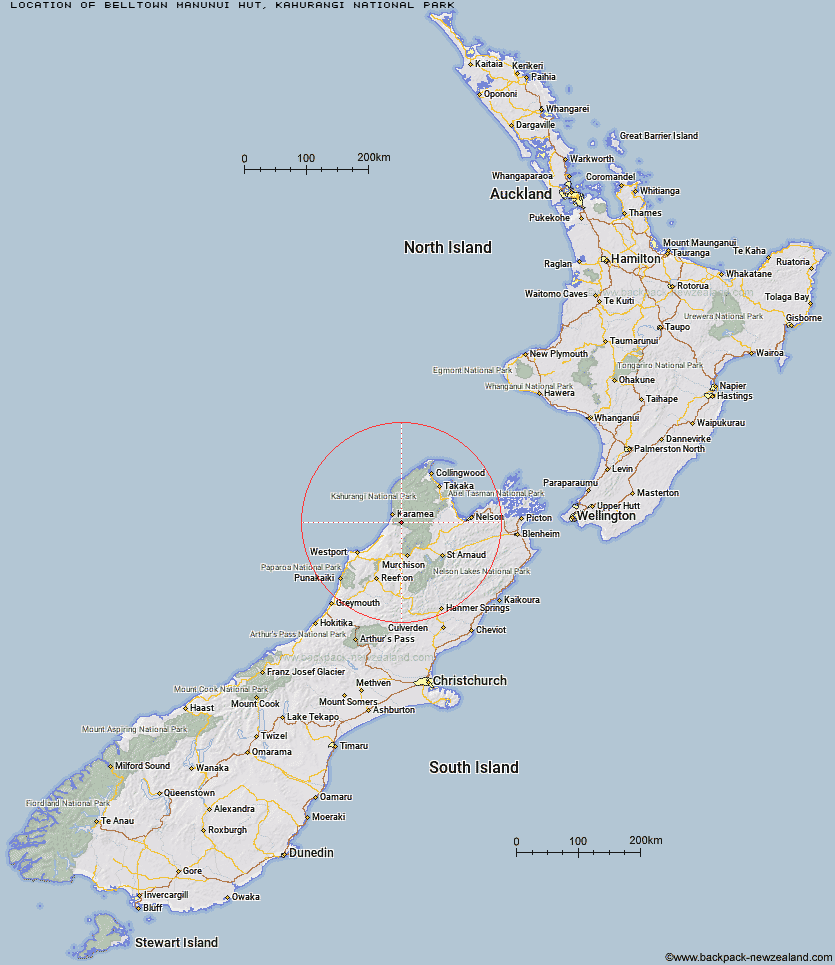
Topo Map showing location of Belltown Manunui Hut
This information is sourced from DoC, LINZ and Openstreetmap. Some of the hut photos are mine and the rest are from DoC. I will be adding an upload feature soon so people can photos of .Belltown Manunui Hut.
Basic info: standard 10-bunk hut in the Buller area.
Latitude: -41.3497894641
Longitude: 172.236955825
Location: Kahurangi National Park
Area: West Coast
Type of Hut: Standard
Tracks: Wangapeka Track
Map: BQ24 Topo Map | Road Map
Does this hut still exist? Have any more information? Contact
Basic info: standard 10-bunk hut in the Buller area.
Latitude: -41.3497894641
Longitude: 172.236955825
Location: Kahurangi National Park
Area: West Coast
Type of Hut: Standard
Tracks: Wangapeka Track
Map: BQ24 Topo Map | Road Map
Does this hut still exist? Have any more information? Contact
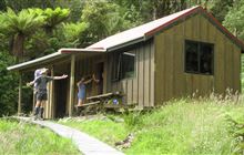
Image: DoC
Scroll down to see a topographical map and road map showing the location of Belltown Manunui Hut
[ A ] [ B ] [ C ] [ D ] [ E ] [ F ] [ G ] [ H ] [ I ] [ J ] [ K ] [ L ] [ M ] [ N ] [ O ] [ P ] [ Q ] [ R ] [ S ] [ T ] [ U ] [ V ] [ W ] [ Y ] [ Z ]
Closest 20 Huts to Belltown Manunui Hut
These are as the crow fliesBelltown Manunui Hut 0km Wangapeka Bivouac 4.72km Kākāpō Hut 5.89km Stag Flat Shelter 7.13km Taipo Hut 8.35km Helicopter Flat Hut 12.71km Greys Hut 12.73km Johnson Hut 13.48km Trevor Carter Hut 13.88km Thor Hut 16.77km Adams Flat Hut 17.06km Venus Hut 17.3km Stone Hut 18.63km Sunshine Flat Shelter 19.95km Crow Hut 20.34km Hurricane Hut 21.26km Kiwi Saddle Hut 22.42km Mokihinui Forks Hut 22.59km Specimen Point Hut 22.8km Roaring Lion Hut 23.57km Cecil Kings Hut 24.05km Kings Creek Hut 24.1km Larrikin Creek Hut 24.28km Karamea Bend Hut 26.32km John Reid Hut 26.73km McConchies Hut 28.48km Goat Creek Hut 28.65km Kohaihai Shelter 29.02km Branch Creek Hut 29.93km Poor Pete's Hut 30.23km Flanagans Hut 30.83km Granity Pass Hut 33.19km Lake Matiri Hut 34.93km Splugeons Rock Shelter 34.96km Stern Valley Hut 35.05km Katipo Creek Shelter 35.67km Balloon Hut 37.97km Ghost Lake Hut 39.48km Ellis Hut 39.51km Trilobite Hut 39.55km