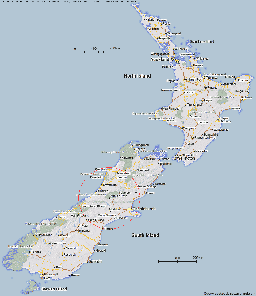
Topo Map showing location of Bealey Spur Hut
This information is sourced from DoC, LINZ and Openstreetmap. Some of the hut photos are mine and the rest are from DoC. I will be adding an upload feature soon so people can photos of .Bealey Spur Hut.
Basic info: basic six-bunk hut in the North Canterbury and Arthur's Pass area. The hut has local historic significance for its role in high country sheep farming.
Latitude: -43.0330353564
Longitude: 171.569893363
Location: Arthur's Pass National Park
Area: Canterbury
Type of Hut: Basic/bivvies
Map: BV20 Topo Map | Road Map
Does this hut still exist? Have any more information? Contact
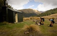
Image: DoC
Scroll down to see a topographical map and road map showing the location of Bealey Spur Hut
[ A ] [ B ] [ C ] [ D ] [ E ] [ F ] [ G ] [ H ] [ I ] [ J ] [ K ] [ L ] [ M ] [ N ] [ O ] [ P ] [ Q ] [ R ] [ S ] [ T ] [ U ] [ V ] [ W ] [ Y ] [ Z ]
Closest 20 Huts to Bealey Spur Hut
These are as the crow fliesLagoon Saddle Hut 3.5km Lagoon Saddle A Frame Hut 3.57km Klondyke Shelter 3.76km Greyneys Shelter 5.67km Bealey Hut 5.86km Anti Crow Hut 6.03km West Harper Hut 8.01km Old Basins Hut 10.4km Basins Hut 10.62km Crow Hut 10.85km Avoca Hut 11.57km Hamilton Hut 11.77km Edwards Hut 11.97km Cass Saddle Hut 12.21km Back Basin Hide 12.61km Jacks Hut 12.65km Carrington Hut 12.8km Mingha Bivouac 13.2km Sudden Valley Bivouac 14.35km Waimakariri Falls Hut 14.47km Barker Hut 14.84km Hawdon Shelter 15.28km Goat Pass Hut 15.29km Upper Deception Hut 16.99km Riversdale Hut 17.39km Andrews Shelter 18.65km Hawdon Hut 18.95km Weka Burnet Bivouac 18.97km Old Julia Hut 19.08km Julia Hut 19.14km Fanghill Hut 19.31km Park Morpeth Hut 19.75km Urquhart's Hut 20.55km Moa Hut 21.81km Hunts Creek Hut 22.09km East Hawdon Bivouac 22.38km Otehake Hut 22.63km Mid Taipo Hut 22.8km Campbell Bivouac 22.96km Manuels Hut 22.97km