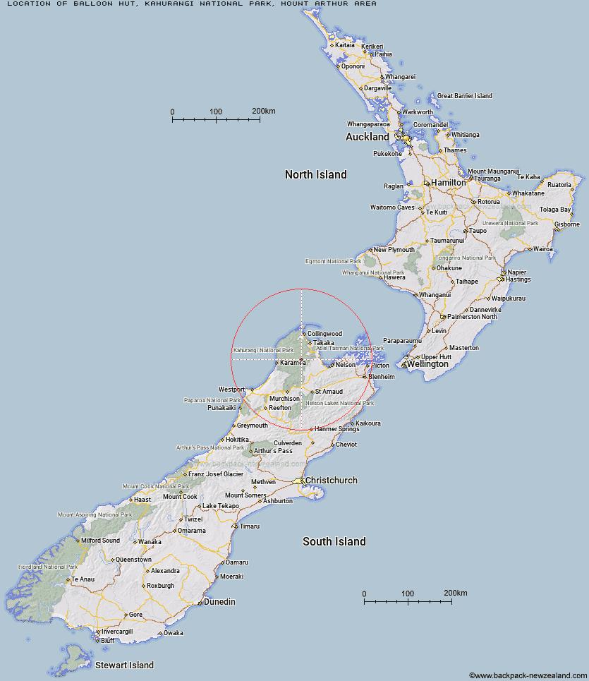
Topo Map showing location of Balloon Hut
This information is sourced from DoC, LINZ and Openstreetmap. Some of the hut photos are mine and the rest are from DoC. I will be adding an upload feature soon so people can photos of .Balloon Hut.
Basic info: serviced 14-bunk hut in the Motueka area.
Latitude: -41.16910341
Longitude: 172.622455382
Location: Kahurangi National Park, Mount Arthur area
Area: Nelson/Tasman
Type of Hut: Serviced
Tracks: Tableland Circuit
Map: BP24 Topo Map | Road Map
Does this hut still exist? Have any more information? Contact
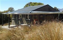
Image: DoC
Scroll down to see a topographical map and road map showing the location of Balloon Hut
[ A ] [ B ] [ C ] [ D ] [ E ] [ F ] [ G ] [ H ] [ I ] [ J ] [ K ] [ L ] [ M ] [ N ] [ O ] [ P ] [ Q ] [ R ] [ S ] [ T ] [ U ] [ V ] [ W ] [ Y ] [ Z ]
Closest 20 Huts to Balloon Hut
These are as the crow fliesDry Rock Shelter 3.3km Myttons Hut 3.71km Splugeons Rock Shelter 4.19km Growler Rock Shelter 4.39km Trilobite Hut 4.46km Upper Gridiron Hut and Rock Shelters 6.21km Sylvester Hut 7.25km Asbestos Cottage 7.28km Mt Arthur Hut 8.43km Flora Hut 9.13km Ellis Hut 9.29km Chaffey Hut 9.33km Flanagans Hut 11.71km Karamea Bend Hut 11.73km Tent Camp 13.53km Waingaro Forks Hut 14.41km Cobb Hut 15km Fenella Hut 15.59km Roaring Lion Hut 16.12km Riordans Hut 17.05km Soper Shelter 18.23km Crow Hut 18.88km Tin Hut Shelter 20.64km Lonely Lake Hut 21.43km Venus Hut 22.45km Anatoki Forks Hut 25.59km Thor Hut 25.61km Adelaide Tarn Hut 26.04km John Reid Hut 26.62km Kiwi Saddle Hut 28.53km Greys Hut 30.03km Boulder Lake Hut 30.15km Stone Hut 31.88km Trevor Carter Hut 32.01km Kākāpō Hut 32.26km Adams Flat Hut 34.44km Kings Creek Hut 35km Perry Saddle Hut 35.03km Helicopter Flat Hut 35.08km Cecil Kings Hut 35.21km