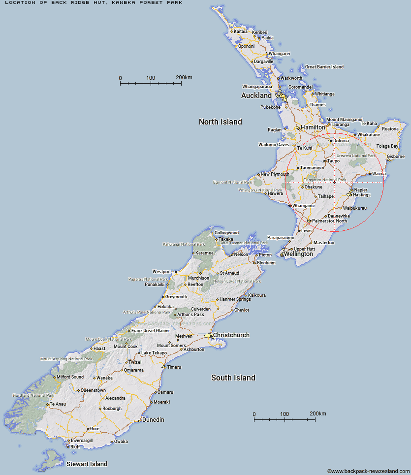
Topo Map showing location of Back Ridge Hut
This information is sourced from DoC, LINZ and Openstreetmap. Some of the hut photos are mine and the rest are from DoC. I will be adding an upload feature soon so people can photos of .Back Ridge Hut.
Basic info: Back Ridge Hut is positioned in a useful stopover location to access the central and western areas of the Kaweka Forest Park.
Latitude: -39.2768412898
Longitude: 176.35645242
Location: Kaweka Forest Park
Area: Hawke's Bay
Type of Hut: Standard
Map: BJ37 Topo Map | Road Map
Does this hut still exist? Have any more information? Contact
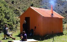
Image: DoC
Scroll down to see a topographical map and road map showing the location of Back Ridge Hut
[ A ] [ B ] [ C ] [ D ] [ E ] [ F ] [ G ] [ H ] [ I ] [ J ] [ K ] [ L ] [ M ] [ N ] [ O ] [ P ] [ Q ] [ R ] [ S ] [ T ] [ U ] [ V ] [ W ] [ Y ] [ Z ]
Closest 20 Huts to Back Ridge Hut
These are as the crow fliesBack Ridge Bivouac 2.56km Studholme Saddle Hut 2.78km Studholme Saddle Bivouac 3.25km Dominie Hut 3.25km Venison Tops Hut (Tira Lodge) 4.45km Ballard Hut 4.47km Makahu Saddle Hut 4.55km Rocks Ahead Hut 5.15km Rocks Ahead Bivouac 5.27km Kaweka Flats Bivouac 5.44km Manson Bivouac 6.26km Omarukokere Bivouac 6.31km Iron Whare 6.78km Mangaturutu Hut 6.81km Mackintosh Hut 6.89km Kiwi Saddle Hut 6.95km Black Birch Bivouac 7.57km Middle Hill Hut 8.17km Old Manson Hut 8.36km Kiwi Mouth Hut 8.55km Manson Hut 8.58km Ngaawapurua Hut 10.39km Otutu Hut 10.63km Makino Hut 10.65km Cameron Hut 10.95km Te Puke (Te Pukeohikarua) Hut 11.54km Otutu Island Hut 12.3km Rock Camp Bivouac 12.58km Harkness Hut 13.56km Lowry Shelter 15.46km Mangatainoka Hut 15.65km Tussock Hut 17.34km Te Matai Hut 18.28km Golden Hills Hut 18.34km Lower Ripia Hut 18.85km Tevers Hut 19.25km Upper Ripia Hut 19.86km Ernie's Creek Hut 20.01km East Creek Hut 21.62km Comet Hut 22.06km