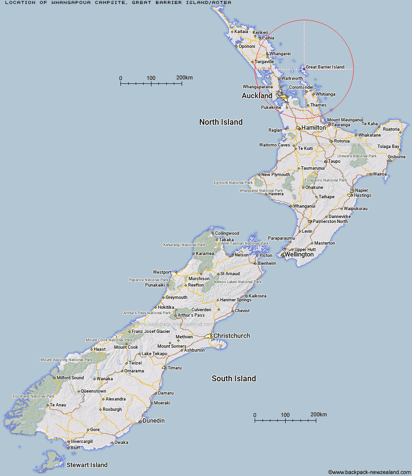
Map showing location of Whangapoua Campsite
Latitude: -36.14512248
Longitude: 175.42182914
Location: Great Barrier Island/Aotea, Auckland
Cost: 18+ $13 :: 17 and under $6.50 :: 0 - 4 free
Access: Car,Campervan,Caravan
Facilities: Shelter for cooking,Shower - cold,Water from tap
DoC Page: Whangapoua Campsite
Longitude: 175.42182914
Location: Great Barrier Island/Aotea, Auckland
Cost: 18+ $13 :: 17 and under $6.50 :: 0 - 4 free
Access: Car,Campervan,Caravan
Facilities: Shelter for cooking,Shower - cold,Water from tap
DoC Page: Whangapoua Campsite
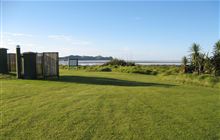
Image: DoC
Scroll down to see a more detailed map showing the location of Whangapoua Campsite
[ A ] [ B ] [ C ] [ D ] [ E ] [ F ] [ G ] [ H ] [ I ] [ J ] [ K ] [ L ] [ M ] [ N ] [ O ] [ P ] [ R ] [ S ] [ T ] [ U ]
Closest 20 Camping sites to Whangapoua Campsite
These are as the crow fliesHarataonga Campsite 5.96km Akapoua Bay Campsite 6.04km Awana Beach Campsite 8.14km The Green Campsite 10.52km Medlands Beach Campsite 15.71km Motuora Campsite 69.34km Home Bay, Motutapu Island Campsite 82.02km Motuihe Campsite 85.14km Uretiti Beach Campsite 89.62km Trestle View Campsite 104.79km Totara Flat Campsite 105.17km Wainora Campsite 105.19km Catleys Campsite 105.65km Booms Flat Campsite 105.76km Whangaiterenga Campsite 106.28km Hotoritori Campsite 107.87km Shag Stream Campsite 110.28km Broken Hills Campsite 110.46km Otamure Bay Campsite 113km Waikahoa Bay Campsite 120km Puriri Bay Campsite 129.26km Dickey Flat Campsite 146.78km Cable Bay Campsite 148.14km Sunset Bay Campsite 148.24km Urupukapuka Bay Campsite 148.52km Puketi Recreation Area Campsite 180.04km Kaniwhaniwha Campsite 201.77km Raetea North Side Campsite 209.8km Arohena Campsite 225.71km Matata Campsite 227.19km Maitai Bay Campsite 233.74km Lake Okareka Campsite 239.21km Lake Tarawera Campsite 246.23km Hot Water Beach Campsite 250.01km Rerewhakaaitu, Ash Pit Road Campsite 255.84km Rerewhakaaitu, Brett Road Campsite 257.29km Ngaherenga Campsite 263.4km Rarawa Beach Campsite 264.29km Kakaho Campsite 270.73km Piropiro Campsite 276.75km