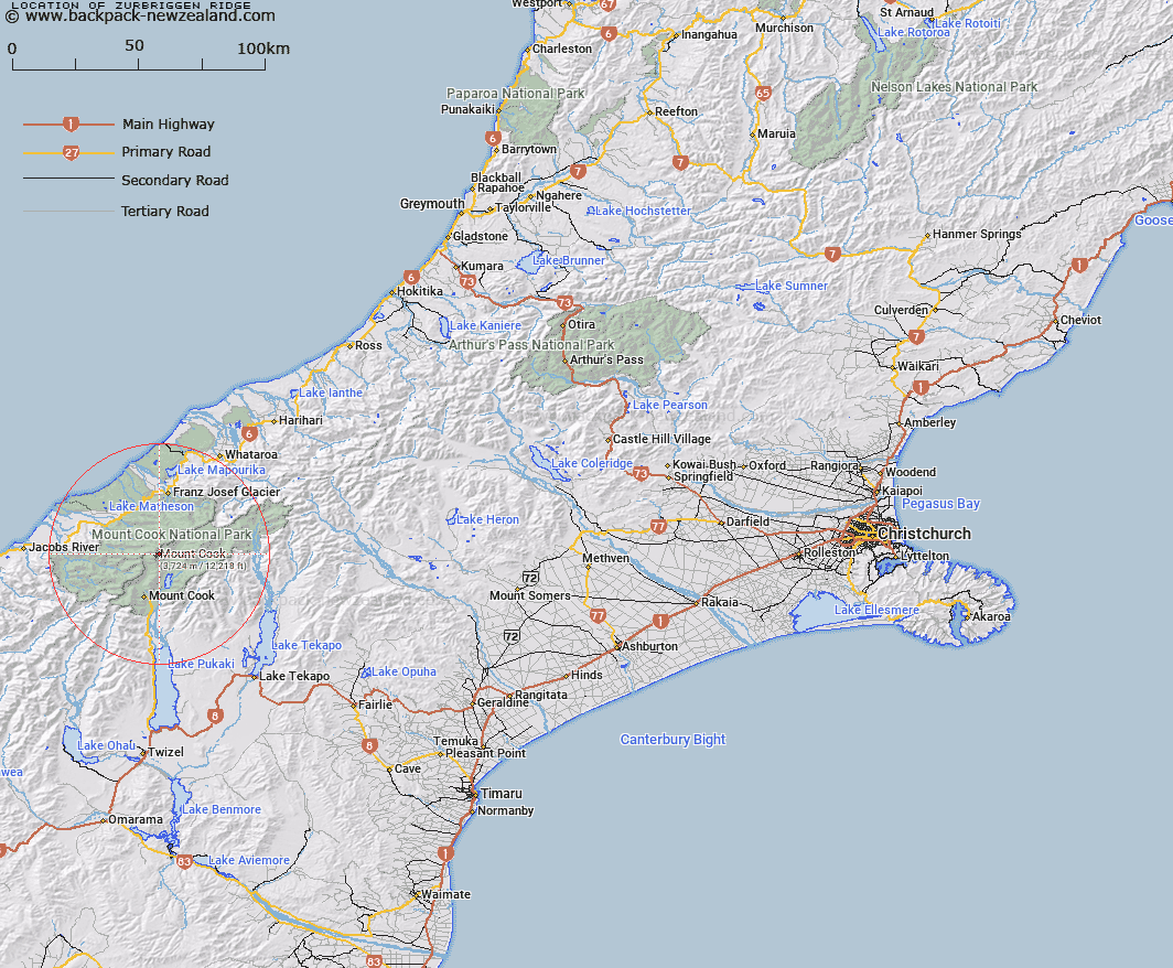
Map showing location of Zurbriggen Ridge


LINZ description: A ridge on Mount Cook extending South-westward from Grand Plateau towards High Peak. Block II Mueller and Block IX Cook Survey Districts.
Latitude: -43.589935
Longitude: 170.153349
Northing: 5169732.9
Easting: 1370201.5
Land District: Canterbury
Feat Type: Ridge


Scroll down to see a more detailed road map and below that a topographical map showing the location of Zurbriggen Ridge. The road map has been supplied by openstreetmap and the topographical map of Zurbriggen Ridge has been supplied by Land Information New Zealand (LINZ).

Yes you can use the top static map for you school/university project or personal website with a link back. Contact me for any commercial use.

Zurbriggen Ridge Map New Zealand


New Zealand places in our database
[ A ] [ B ] [ C ] [ D ] [ E ] [ F ] [ G ] [ H ] [ I ] [ J ] [ K ] [ L ] [ M ] [ N ] [ O ] [ P ] [ Q ] [ R ] [ S ] [ T ] [ U ] [ V ] [ W ] [ X ] [ Y ] [ Z ]


Closest 20 Ridges to Zurbriggen Ridge

Bowie Ridge ( 0.4km )   North East Ridge ( 0.69km )   North Ridge ( 1.04km )   East Ridge ( 1.69km )   Earle Ridge ( 2.11km )   North West Ridge ( 2.62km )   Hillary Ridge ( 2.76km )   South Ridge ( 2.76km )   Syme Ridge ( 2.83km )   West Ridge ( 3.31km )   Haast Ridge ( 3.81km )   Ayres Ridge ( 6.25km )   Pioneer Ridge ( 7.2km )   Passchendaele Ridge ( 9.09km )   Paschendale Ridge ( 9.09km )   Chancellor Ridge ( 9.98km )   Penck Ridge ( 10.37km )   De la Beche Ridge ( 10.76km )   Sollas Ridge ( 11.02km )   Linden Ridge ( 13.01km )   Lindon Ridge ( 13.01km )   Crumbling Ridge ( 13.09km )   Huntington Ridge ( 13.63km )   Botanical Spur ( 13.63km )   Hende Ridge ( 14.93km )   Coulter Ridge ( 15.63km )   Drummond Ridge ( 16.79km )   Burton Range ( 18.93km )   Burton Ridge ( 18.93km )   Hoophorn Spur ( 19.97km )   Cole Spur ( 24.2km )   Gunn Ridge ( 28.72km )   Joseph Ridge ( 28.98km )   Little Rough ( 29.75km )   Big Rough ( 31.09km )   Razor Back ( 35.03km )   Little Spur ( 43.75km )   Big Spur ( 44.13km )   Murphy Spur ( 44.33km )   The Razorback ( 45.95km )