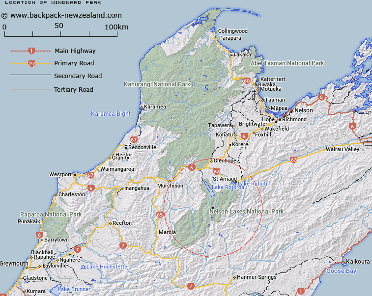
Map showing location of Windward Peak


LINZ description: Peak on Mahanga Range west of the confluence of the Sabine River East and West Branches.
Latitude: -42.001288
Longitude: 172.661963
Northing: 5350025.5
Easting: 1572005.1
Land District: Nelson
Feat Type: Hill


Scroll down to see a more detailed road map and below that a topographical map showing the location of Windward Peak. The road map has been supplied by openstreetmap and the topographical map of Windward Peak has been supplied by Land Information New Zealand (LINZ).

Yes you can use the top static map for you school/university project or personal website with a link back. Contact me for any commercial use.

Windward Peak Map New Zealand


New Zealand places in our database
[ A ] [ B ] [ C ] [ D ] [ E ] [ F ] [ G ] [ H ] [ I ] [ J ] [ K ] [ L ] [ M ] [ N ] [ O ] [ P ] [ Q ] [ R ] [ S ] [ T ] [ U ] [ V ] [ W ] [ X ] [ Y ] [ Z ]


Closest 20 Hills to Windward Peak

Mount Cupola ( 5.13km )   Mount Franklin ( 5.98km )   Mount Travers ( 6.2km )   Mount Watson ( 7.25km )   Mount Misery ( 7.51km )   Mole Tops ( 7.64km )   Kehu Peak ( 8.56km )   Mount Hopeless ( 8.74km )   Mount McKay ( 9.74km )   Cotterell Peak ( 10.95km )   Mount Hutton ( 11.01km )   Mount Ella ( 11.19km )   Mount Mahanga ( 11.44km )   Mount Paske ( 11.81km )   Burnt Spur ( 12.23km )   Belvedere Peak ( 12.37km )   Mount Cedric ( 12.42km )   Maniniaro / Angelus Peak ( 12.43km )   Angelus Peak ( 12.43km )   Crag ( 12.76km )   Mount Chittenden ( 13.13km )   The Camel ( 13.98km )   Mount Magdalene ( 14.02km )   Three Peaks ( 14.79km )   Mount Dorothy ( 14.85km )   Mount Dora ( 15.82km )   Playfair ( 15.86km )   Mount Iris ( 16.01km )   Mount Guinevere ( 16.26km )   Thomson ( 16.79km )   Nardoo ( 17.23km )   Peanter Peak ( 17.62km )   Spenser Range ( 17.79km )   Spenser Mountains ( 17.79km )   Downie ( 17.91km )   Julius Peak ( 17.92km )   Spaniard Face ( 18.13km )   Mount Cashel ( 18.15km )   Crystal Peak ( 19.25km )   Mount Weld ( 19.26km )