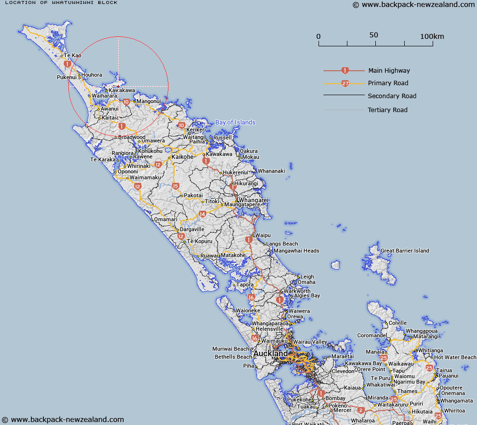
Map showing location of Whatuwhiwhi Block


LINZ description: Survey Block on eastern side of Karikari Penninsula extending under the south of Toupiroroa Range to the coast.
Latitude: -34.878084
Longitude: 173.410343
Northing: 6140400
Easting: 1637500
Land District: North Auckland
Feat Type: Appellation


Scroll down to see a more detailed road map and below that a topographical map showing the location of Whatuwhiwhi Block. The road map has been supplied by openstreetmap and the topographical map of Whatuwhiwhi Block has been supplied by Land Information New Zealand (LINZ).

Yes you can use the top static map for you school/university project or personal website with a link back. Contact me for any commercial use.

Whatuwhiwhi Block Map New Zealand


New Zealand places in our database
[ A ] [ B ] [ C ] [ D ] [ E ] [ F ] [ G ] [ H ] [ I ] [ J ] [ K ] [ L ] [ M ] [ N ] [ O ] [ P ] [ Q ] [ R ] [ S ] [ T ] [ U ] [ V ] [ W ] [ X ] [ Y ] [ Z ]


Closest 20 Appellations to Whatuwhiwhi Block

Houhora East Survey District ( 32.55km )   Hohoura East ( 32.55km )   Houhora West Survey District ( 43.19km )   Hohoura West ( 43.19km )   Te Uwhi Block ( 83.7km )   Waikare Block ( 90.3km )   Mangawhai Parish ( 173.04km )   Mangawai Parish ( 173.04km )   Waitakere Block ( 242.44km )   Waitakerei Block ( 242.44km )   Mawhitipana Maori Block ( 257.89km )   Mawitipana Maori Block ( 257.89km )   Kirita Maori Block ( 286.72km )   Otamaurunganui Block ( 348.01km )   Otamaurunganu Block ( 348.01km )   Waire Settlement ( 419.47km )   Waiari Settlement ( 419.47km )   Mangapehi ( 437.35km )   Awaateatua Survey District ( 448.78km )   Waiotahi Parish ( 488.99km )   Waiotahe Parish ( 488.99km )   Waioeka Parish ( 496.93km )   Wheao Survey District ( 498.62km )   Weao ( 498.62km )   Ngatira ( 502.64km )   Ngatiira ( 502.64km )   Waiawa East ( 513.06km )   Waiaua East Survey District ( 513.06km )   Matengareka Block ( 518.41km )   Matangareka Block ( 518.41km )   Whakapaupakihi ( 526.59km )   Whakapaupakahi ( 526.59km )   Mangaparahi Block ( 527.38km )   Maungaparahi Block ( 527.38km )   Tuwatawata ( 527.95km )   Tuawatawata ( 527.95km )   Tuatawhata ( 527.95km )   Waiorongomai Block ( 532.18km )   Meakokutea ( 540.42km )   Maikukutea ( 540.42km )