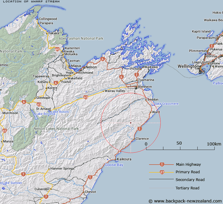
Map showing location of Wharf Stream
LINZ description: Feature shown on: NZMS260 P30 Edition 1 1990. Located in the northern seaward Kaikoura Range. One of four streams at the north-east end of the Clarence Valley join to form the Ouse River which flows south-west to join the Clarence River.
Latitude: -41.954889
Longitude: 173.880417
Northing: 5354857.6
Easting: 1672965.8
Land District: Marlborough
Feat Type: Stream
Latitude: -41.954889
Longitude: 173.880417
Northing: 5354857.6
Easting: 1672965.8
Land District: Marlborough
Feat Type: Stream

Scroll down to see a more detailed road map and below that a topographical map showing the location of Wharf Stream. The road map has been supplied by openstreetmap and the topographical map of Wharf Stream has been supplied by Land Information New Zealand (LINZ).
Yes you can use the top static map for you school/university project or personal website with a link back. Contact me for any commercial use.
[ A ] [ B ] [ C ] [ D ] [ E ] [ F ] [ G ] [ H ] [ I ] [ J ] [ K ] [ L ] [ M ] [ N ] [ O ] [ P ] [ Q ] [ R ] [ S ] [ T ] [ U ] [ V ] [ W ] [ X ] [ Y ] [ Z ]