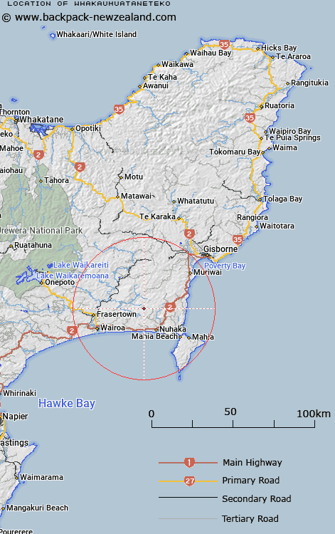
Map showing location of Whakaumuataneteko
LINZ description: Hill over 600m 2.5Km East of Tangihanga (B1HP), 4.8km South of Te Kaihekiapanui (APB1), and 5.2km South-west of Hurukino (B1XH). Nuhaka North Survey District.
Latitude: -38.938172
Longitude: 177.675356
Northing: 5679679
Easting: 2005294.5
Land District: Gisborne
Feat Type: Trig Station
Latitude: -38.938172
Longitude: 177.675356
Northing: 5679679
Easting: 2005294.5
Land District: Gisborne
Feat Type: Trig Station

Scroll down to see a more detailed road map and below that a topographical map showing the location of Whakaumuataneteko. The road map has been supplied by openstreetmap and the topographical map of Whakaumuataneteko has been supplied by Land Information New Zealand (LINZ).
Yes you can use the top static map for you school/university project or personal website with a link back. Contact me for any commercial use.
[ A ] [ B ] [ C ] [ D ] [ E ] [ F ] [ G ] [ H ] [ I ] [ J ] [ K ] [ L ] [ M ] [ N ] [ O ] [ P ] [ Q ] [ R ] [ S ] [ T ] [ U ] [ V ] [ W ] [ X ] [ Y ] [ Z ]