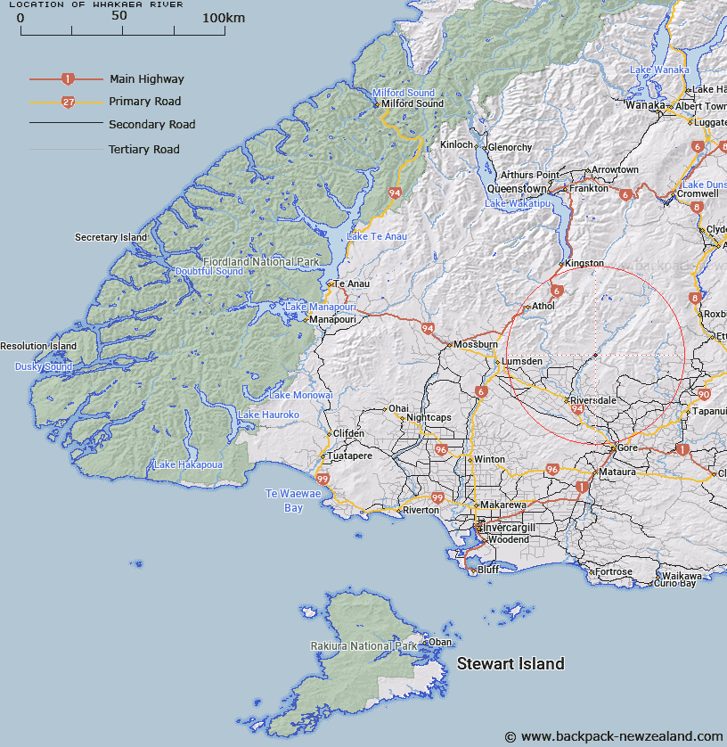
Map showing location of Whakaea River


LINZ description: Tributary of the Mataura River with it's source in the Garvie Mountains and the Old Woman Range. Waikaia and other Survey Districts.
Latitude: -45.708328
Longitude: 168.866484
Northing: 4930044
Easting: 1278261.4
Land District: Southland
Feat Type: Stream


Scroll down to see a more detailed road map and below that a topographical map showing the location of Whakaea River. The road map has been supplied by openstreetmap and the topographical map of Whakaea River has been supplied by Land Information New Zealand (LINZ).

Yes you can use the top static map for you school/university project or personal website with a link back. Contact me for any commercial use.

Whakaea River Map New Zealand


New Zealand places in our database
[ A ] [ B ] [ C ] [ D ] [ E ] [ F ] [ G ] [ H ] [ I ] [ J ] [ K ] [ L ] [ M ] [ N ] [ O ] [ P ] [ Q ] [ R ] [ S ] [ T ] [ U ] [ V ] [ W ] [ X ] [ Y ] [ Z ]


Closest 20 Streams to Whakaea River

Washpool Creek ( 6.19km )   Winding Creek ( 7.34km )   Station Burn ( 7.94km )   Steven Burn ( 9.39km )   Boundary Creek ( 11.01km )   Steeple Burn ( 12.08km )   Wendon Stream ( 12.4km )   Knobby Creek ( 12.71km )   Garvie Burn ( 13.4km )   Archies Creek ( 14.29km )   Murray Burn ( 14.32km )   Argyle Burn ( 14.36km )   Waikaka Stream ( 15.39km )   Dome Burn ( 15.62km )   Pyramid Creek ( 16.12km )   Sandy Creek ( 16.6km )   Mill Creek ( 17.06km )   Gorge Creek ( 17.07km )   Camping Creek ( 17.93km )   Parasol Creek ( 18.07km )   Leithen Burn ( 18.16km )   Little Parasol Creek ( 18.5km )   Boggy Creek ( 18.83km )   Charcoal Creek ( 19.26km )   Doakes Stream ( 19.46km )   Whitecoomb Creek ( 20.3km )   Sheepwash Creek ( 20.43km )   East Branch Waikaka Stream ( 22.82km )   Jordan or Black Creek ( 22.86km )   South Twin Creek ( 23.05km )   Post Office Creek ( 23.11km )   Wart Hill Creek ( 23.65km )   Bullock Head Creek ( 23.66km )   North Twin Creek ( 23.67km )   Larnach Stream ( 23.76km )   Camerons Creek ( 23.86km )   Sharks Bay Creek ( 23.93km )   Little Welshmans Creek ( 23.94km )   Tin Hut Creek ( 23.98km )   Thompsons Creek ( 23.99km )