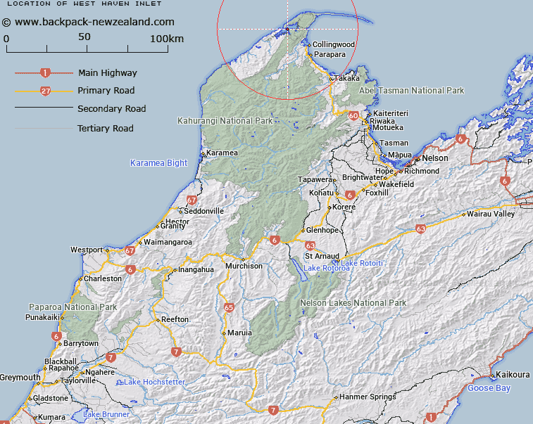
Map showing location of West Haven Inlet


LINZ description: Inlet located approximately 16km south of Cape Farewell.
Latitude: -40.590837
Longitude: 172.566213
Northing: 5506571.9
Easting: 1563293.2
Land District: Nelson
Feat Type: Bay


Scroll down to see a more detailed road map and below that a topographical map showing the location of West Haven Inlet. The road map has been supplied by openstreetmap and the topographical map of West Haven Inlet has been supplied by Land Information New Zealand (LINZ).

Yes you can use the top static map for you school/university project or personal website with a link back. Contact me for any commercial use.

West Haven Inlet Map New Zealand


New Zealand places in our database
[ A ] [ B ] [ C ] [ D ] [ E ] [ F ] [ G ] [ H ] [ I ] [ J ] [ K ] [ L ] [ M ] [ N ] [ O ] [ P ] [ Q ] [ R ] [ S ] [ T ] [ U ] [ V ] [ W ] [ X ] [ Y ] [ Z ]


Closest 20 Bays to West Haven Inlet

Ng?roa Bay ( 8.85km )   P?kawau Inlet ( 9.73km )   Ruataniwha Inlet ( 10.91km )   Parapara Inlet ( 17.71km )   Golden Bay / Mohua ( 25.42km )   Golden Bay ( 25.42km )   Limestone Bay ( 37.95km )   Tata Bay ( 37.98km )   Ligar Bay ( 38.34km )   Wainui Bay ( 39.34km )   Whariwharangi Bay ( 40.58km )   Wainui Inlet ( 40.63km )   Takapou Bay ( 40.64km )   Mutton Cove ( 42.42km )   Anatakapau Bay ( 42.67km )   Seal Bay ( 43.19km )   Anapai Bay ( 43.99km )   Goat Bay ( 46.43km )   Waiharakeke Bay ( 47.43km )   Awaroa Inlet ( 48.2km )   Big Bay ( 48.71km )   Awaroa Bay ( 49.29km )   Canoe Bay ( 49.99km )   Brereton Cove ( 51.05km )   Shag Harbour ( 52.22km )   Mosquito Bay ( 54.96km )   Bark Bay ( 55.2km )   Sandfly Bay ( 55.73km )   Frenchman Bay ( 56.31km )   Boundary Bay ( 56.78km )   R?kauroa / Torrent Bay ( 57.02km )   Torrent Bay ( 57.02km )   The Anchorage ( 57.75km )   Te Pukatea Bay ( 58.23km )   Cyathea Cove ( 58.51km )   Cyathees Cove ( 58.51km )   Watering Cove ( 58.57km )   Stilwell Bay ( 58.65km )   Akersten Bay ( 58.7km )   Anchor Bay ( 58.79km )