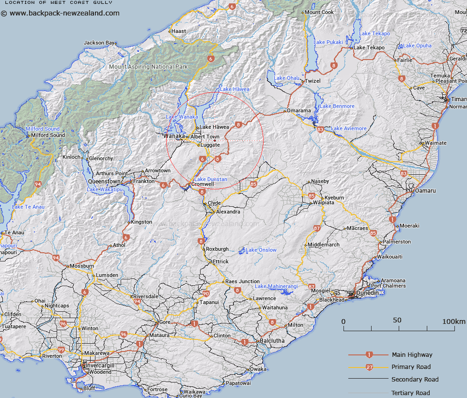
Map showing location of West Coast Gully


LINZ description: Creek approximately 5 km long, 14 km north of Tarras.
Latitude: -44.708783
Longitude: 169.402156
Northing: 5043100
Easting: 1315000
Land District: Otago
Feat Type: Valley


Scroll down to see a more detailed road map and below that a topographical map showing the location of West Coast Gully. The road map has been supplied by openstreetmap and the topographical map of West Coast Gully has been supplied by Land Information New Zealand (LINZ).

Yes you can use the top static map for you school/university project or personal website with a link back. Contact me for any commercial use.

West Coast Gully Map New Zealand


New Zealand places in our database
[ A ] [ B ] [ C ] [ D ] [ E ] [ F ] [ G ] [ H ] [ I ] [ J ] [ K ] [ L ] [ M ] [ N ] [ O ] [ P ] [ Q ] [ R ] [ S ] [ T ] [ U ] [ V ] [ W ] [ X ] [ Y ] [ Z ]


Closest 20 Valleys to West Coast Gully

Big Gully ( 1.85km )   Deep Gully ( 5.88km )   Long Gully ( 7.63km )   Cameron Gully ( 10.19km )   Pleasant Valley ( 17.31km )   Richmond Valley ( 22.54km )   Chinaman Gully ( 24.78km )   Breakneck Gully ( 27.25km )   Wide Gully ( 28.54km )   Harveys Gully ( 29.2km )   Humbug Gully ( 31.37km )   Welshmans Gully ( 32.07km )   Hatters Gully ( 32.15km )   Clay Bank Gully ( 34.07km )   Birchalls Gully ( 34.38km )   Kellys Gully ( 34.44km )   Wheelers Gully ( 34.58km )   Coffee Gully ( 34.62km )   Chinaman Gully ( 35.01km )   Packspur Gully ( 35.51km )   Tuohys Gully ( 35.58km )   Charcoal Gully ( 36.52km )   German Gully ( 36.59km )   Green Gully ( 37.64km )   Swampy Gully ( 38.84km )   Chimney Gully ( 40.11km )   Manuherikia Valley ( 40.2km )   Rodies Gully ( 40.69km )   Long Gully ( 40.82km )   Horse Gully ( 41.49km )   Ritchies Gully ( 41.81km )   Shamrock Gully ( 42.1km )   Kawarau Gorge ( 42.4km )   Horse Gully ( 42.81km )   Pennyweight Gully ( 43.07km )   Maori Gully ( 43.16km )   Masons Gully ( 43.19km )   Bricks Gully ( 44.19km )   Cairnmuir Gully ( 44.51km )   Pegleg Gully ( 44.71km )