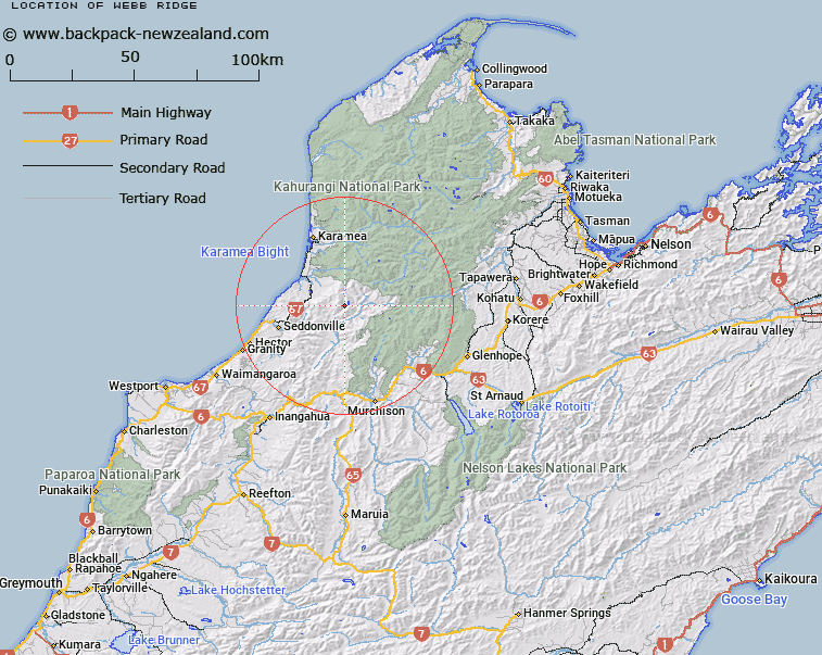
Map showing location of Webb Ridge
LINZ description: Ridge extending southward from spot height 1308m, 700m North of Maris Peak on the Radiant Range, through Marris Peak, Mount Webb (Geodetic Code A6KE), and Mount Young, towards the Hemphill River/ Maori gully junction. Block XIV Otumahana and Block III Marina Survey Districts.
Latitude: -41.476017
Longitude: 172.218452
Northing: 5408103.5
Easting: 1534745.5
Land District: Nelson
Feat Type: Ridge
Latitude: -41.476017
Longitude: 172.218452
Northing: 5408103.5
Easting: 1534745.5
Land District: Nelson
Feat Type: Ridge

Scroll down to see a more detailed road map and below that a topographical map showing the location of Webb Ridge. The road map has been supplied by openstreetmap and the topographical map of Webb Ridge has been supplied by Land Information New Zealand (LINZ).
Yes you can use the top static map for you school/university project or personal website with a link back. Contact me for any commercial use.
[ A ] [ B ] [ C ] [ D ] [ E ] [ F ] [ G ] [ H ] [ I ] [ J ] [ K ] [ L ] [ M ] [ N ] [ O ] [ P ] [ Q ] [ R ] [ S ] [ T ] [ U ] [ V ] [ W ] [ X ] [ Y ] [ Z ]