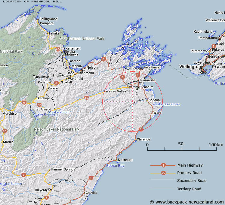
Map showing location of Washpool Hill


LINZ description: Small hill feature in between Boundary Creek, Blairich River and Troloves Stream.
Latitude: -41.6873
Longitude: 173.890549
Northing: 5384558.4
Easting: 1674113.5
Land District: Marlborough
Feat Type: Hill


Scroll down to see a more detailed road map and below that a topographical map showing the location of Washpool Hill. The road map has been supplied by openstreetmap and the topographical map of Washpool Hill has been supplied by Land Information New Zealand (LINZ).

Yes you can use the top static map for you school/university project or personal website with a link back. Contact me for any commercial use.

Washpool Hill Map New Zealand


New Zealand places in our database
[ A ] [ B ] [ C ] [ D ] [ E ] [ F ] [ G ] [ H ] [ I ] [ J ] [ K ] [ L ] [ M ] [ N ] [ O ] [ P ] [ Q ] [ R ] [ S ] [ T ] [ U ] [ V ] [ W ] [ X ] [ Y ] [ Z ]


Closest 20 Hills to Washpool Hill

Little Ned ( 4.17km )   The Ned ( 5.43km )   The William ( 8.06km )   Blairich ( 8.17km )   Newport Knob ( 8.31km )   Upton ( 8.93km )   Wards Peak ( 9.56km )   Sugar Loaf ( 10.35km )   Fells Hill ( 11.5km )   Vinegar Point ( 11.53km )   Altimarloch ( 12km )   Star Hill ( 13.19km )   Richmond Hill ( 13.85km )   Mount Harkness ( 14.1km )   Craigs Peak ( 14.12km )   Camp Hill ( 14.37km )   Trevors Peak ( 14.75km )   Monument ( 14.94km )   Mount Horrible ( 15.03km )   Newcome Knob ( 16.27km )   Newcombe Knob ( 16.27km )   The Throne ( 16.44km )   Cow Hill ( 16.68km )   Pudding Hill ( 16.78km )   Peggioh ( 16.94km )   Hikurangi / Goulter Hill ( 17.67km )   The Rock ( 18.21km )   Jeanies Knob ( 18.36km )   Big Hill ( 18.44km )   Blue Mountain ( 18.92km )   Little Cregan ( 18.99km )   Conical Hill ( 18.99km )   The Pyramid ( 19.15km )   Needles ( 19.27km )   Reserve Hill ( 19.39km )   Saddle Hill ( 19.47km )   Round Hill ( 19.6km )   Horseshoe Hill ( 19.61km )   Dog Hill ( 19.76km )   Welds Hill ( 19.82km )