Map showing location of Walker Island


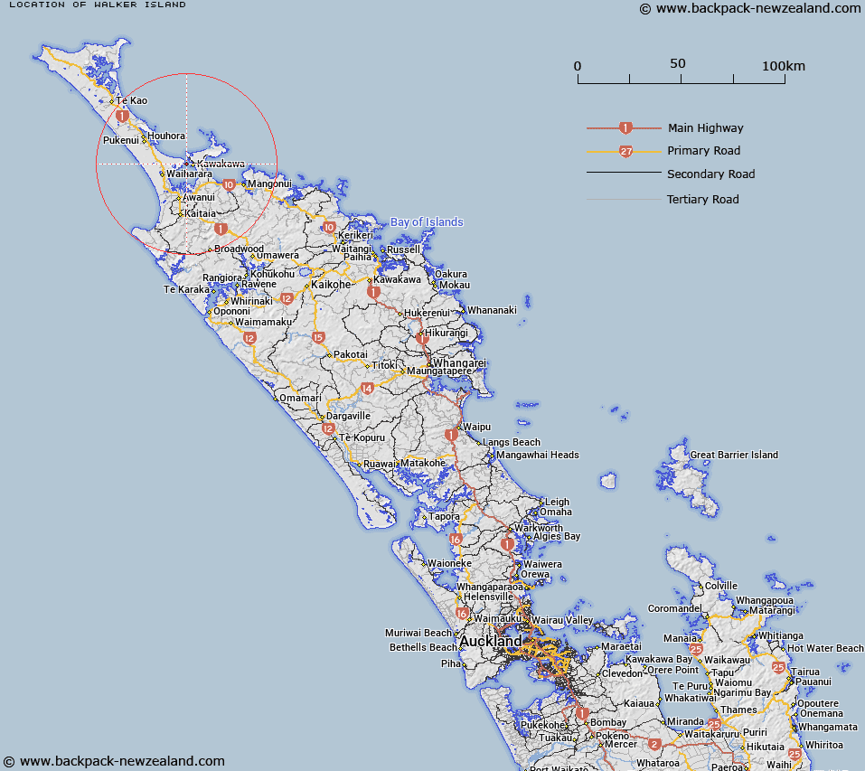
LINZ description: A small estuarine island up to 1km in length at low tide, near the entrance to Rangaunu Harbour and west of Karikari Peninsula. Feature shown on: NZMS260 O04 Edition 1 1984; NZTopo50-AU26 265372.
Latitude: -34.908722
Longitude: 173.291861
Northing: 6137040.4
Easting: 1626662.4
Land District: North Auckland
Feat Type: Island


Scroll down to see a more detailed road map and below that a topographical map showing the location of Walker Island. The road map has been supplied by openstreetmap and the topographical map of Walker Island has been supplied by Land Information New Zealand (LINZ).

Yes you can use the top static map for you school/university project or personal website with a link back. Contact me for any commercial use.

Walker Island Map New Zealand


New Zealand places in our database
[ A ] [ B ] [ C ] [ D ] [ E ] [ F ] [ G ] [ H ] [ I ] [ J ] [ K ] [ L ] [ M ] [ N ] [ O ] [ P ] [ Q ] [ R ] [ S ] [ T ] [ U ] [ V ] [ W ] [ X ] [ Y ] [ Z ]


Closest 20 Islands to Walker Island

Tangihana Shell Bank ( 0.98km )   Scheigis Rock ( 2.14km )   Motutara Rocks ( 5.9km )   Rat Island ( 6.54km )   Motukaraka Island ( 6.85km )   Mangrove Island ( 8.26km )   Omaia Island ( 9.03km )   Okatakata Islands ( 10km )   Sugarloaf Island ( 15.16km )   Motutapu Island ( 15.46km )   Green Island ( 15.46km )   Puketu Island ( 15.65km )   Whale Island ( 15.65km )   Tuputupungahau Island ( 15.65km )   Moturoa Islands ( 15.82km )   Moturoa Island ( 16.15km )   Tokoroa Island ( 16.2km )   Rocky Island ( 17.53km )   Motuotuna Island ( 17.73km )   Motu Puruhi Island ( 21.05km )   Simmonds Islands ( 21.06km )   Terakautuhaka Island ( 21.08km )   Paewhenua Island ( 25.93km )   Tekura Rocks ( 25.93km )   Motutara Island ( 25.99km )   Rahui Rock ( 30.45km )   Wekarua Island (Sugar Loaf) ( 33.22km )   Bird Rock ( 35.71km )   Cone Rock (Horoiwi) ( 36.6km )   Seal Rock ( 38.08km )   Pa Island ( 38.47km )   Matanehunehu Island ( 38.47km )   Kawa Rock ( 39.28km )   Hororoa Rock ( 39.4km )   Motu Kauri Island ( 42.57km )   Motu Wai Island (Red Island) ( 43.09km )   Shark Island ( 43.63km )   Cone Island ( 43.65km )   Ohauroro Island ( 43.8km )   Te Wakatehaua Island ( 44.31km )