Map showing location of Wairakai


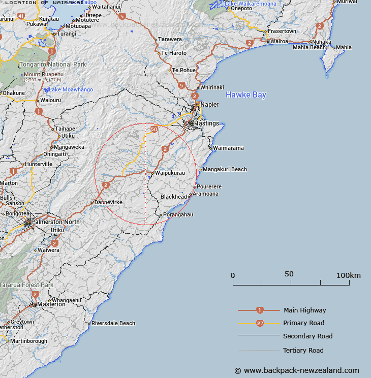
LINZ description: Located approximately 5km west of Waipukurau (locality) on a height of 310m.
Latitude: -40.001656
Longitude: 176.49667
Northing: 5566200
Easting: 1898500
Land District: Hawke's Bay
Feat Type: Trig Station


Scroll down to see a more detailed road map and below that a topographical map showing the location of Wairakai. The road map has been supplied by openstreetmap and the topographical map of Wairakai has been supplied by Land Information New Zealand (LINZ).

Yes you can use the top static map for you school/university project or personal website with a link back. Contact me for any commercial use.

Wairakai Map New Zealand


New Zealand places in our database
[ A ] [ B ] [ C ] [ D ] [ E ] [ F ] [ G ] [ H ] [ I ] [ J ] [ K ] [ L ] [ M ] [ N ] [ O ] [ P ] [ Q ] [ R ] [ S ] [ T ] [ U ] [ V ] [ W ] [ X ] [ Y ] [ Z ]


Closest 20 Trig Stations to Wairakai

Ohuinga ( 35.13km )   Paemutu ( 36.09km )   Salisbury ( 36.54km )   Te Atuaoparapara ( 37.69km )   Kauranaki ( 39.38km )   Kahuranaki ( 39.38km )   Mangaweka ( 40.6km )   Kawhatau ( 40.6km )   Pohatuhaha ( 43.07km )   Parks Peak ( 43.07km )   Waikamaka ( 43.38km )   Remutupo ( 43.38km )   Wahataura ( 51.93km )   Wahatuara ( 51.93km )   Matanginui ( 52.15km )   Matanganui ( 52.15km )   Otuarehua ( 52.97km )   Ross ( 57.29km )   Puketautahi ( 57.54km )   Wharite ( 61.15km )   Kohinga ( 66.3km )   Pukemiki ( 72.2km )   Pukenikau ( 72.2km )   Kuripapango ( 72.77km )   Kupukore ( 77.11km )   Kopukore ( 77.11km )   Kaiarahi ( 77.44km )   End ( 79.93km )   Pakowai ( 81.84km )   Pakowhai ( 81.84km )   Tawake Tohunga ( 87.92km )   Tauwheketewhango ( 87.92km )   Tawai-Tohunga ( 87.92km )   Tawheketewhango ( 87.92km )   Mangamahu ( 90.92km )   Wakaateo ( 91.6km )   Waka Atea ( 91.6km )   Parahakipaku ( 93.78km )   Thunderbolt ( 101.79km )   Parawanui ( 103.33km )