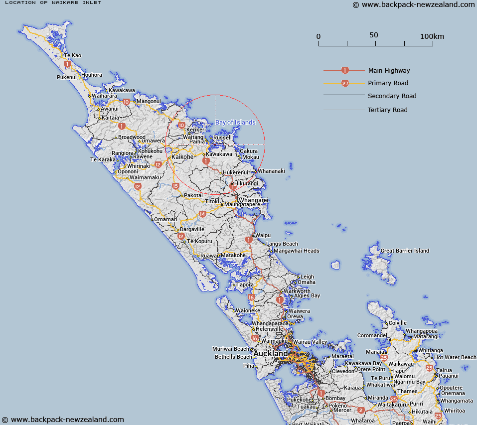
Map showing location of Waikare Inlet


LINZ description: Inlet south of Russell extending from Veronica Channel to the start of the Waikare River.
Latitude: -35.310599
Longitude: 174.155019
Northing: 6091900
Easting: 1705000
Land District: North Auckland
Feat Type: Bay


Scroll down to see a more detailed road map and below that a topographical map showing the location of Waikare Inlet. The road map has been supplied by openstreetmap and the topographical map of Waikare Inlet has been supplied by Land Information New Zealand (LINZ).

Yes you can use the top static map for you school/university project or personal website with a link back. Contact me for any commercial use.

Waikare Inlet Map New Zealand


New Zealand places in our database
[ A ] [ B ] [ C ] [ D ] [ E ] [ F ] [ G ] [ H ] [ I ] [ J ] [ K ] [ L ] [ M ] [ N ] [ O ] [ P ] [ Q ] [ R ] [ S ] [ T ] [ U ] [ V ] [ W ] [ X ] [ Y ] [ Z ]


Closest 20 Bays to Waikare Inlet

Orongo Bay ( 2.92km )   Pipiroa Bay ( 3.58km )   Te Wahapu Inlet ( 3.64km )   English Bay ( 4.01km )   Paroa Bay ( 4.04km )   Uruti Bay ( 4.09km )   Pomare Bay ( 4.85km )   Opito Bay ( 5.19km )   Matauwhi Bay ( 5.46km )   Clendon Cove ( 5.62km )   Onerua Bay ( 6.11km )   Oneroa Bay ( 6.11km )   Tahapuke Bay ( 6.23km )   Jacks Bay ( 6.46km )   Waitata Bay ( 6.46km )   Manawara Bay ( 6.51km )   Manawaora Bay ( 6.51km )   Kororareka Bay ( 6.61km )   Te Angamate Bay ( 6.76km )   Dicks Bay ( 6.89km )   Assassination Cove ( 7.22km )   Orokawa Bay ( 7.33km )   Te Hue Bay ( 7.4km )   Te Huruhi Bay ( 7.44km )   Te Ti Bay ( 7.48km )   Opunga Cove ( 7.59km )   Waihihi Bay ( 7.72km )   Putakokota Bay ( 8.01km )   Cooks Cove ( 8.06km )   Te Rawhiti Inlet ( 8.42km )   Waipiro Bay ( 8.65km )   Waipohutukawa Bay ( 8.67km )   Waiti Bay ( 9.22km )   Huirangi Inlet ( 9.26km )   Pareanui Bay ( 9.32km )   Wairaka Bay ( 9.44km )   Waipao Bay ( 9.63km )   Wairoa Bay ( 9.66km )   Parorenui Bay ( 9.68km )   Te Uenga Bay ( 9.8km )