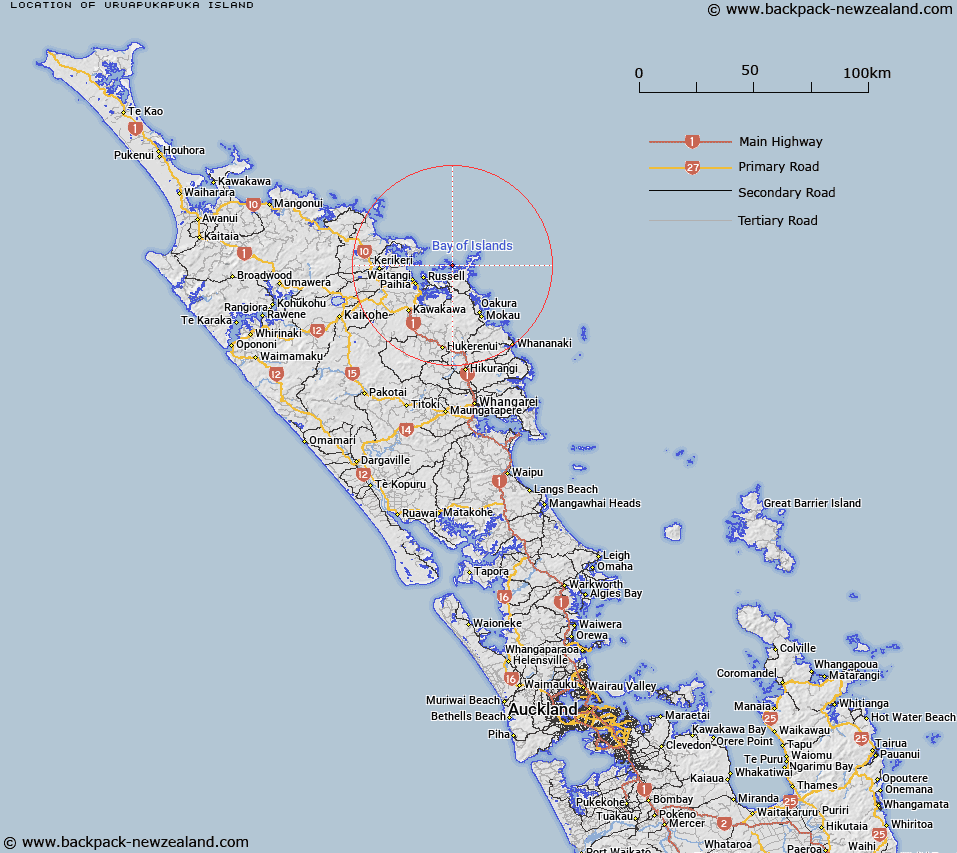
Map showing location of Uruapukapuka Island


LINZ description: Island in eastern Bay of Islands, north west of Rawhiti between the Waewaetorea Passage and Albert Channel.
Latitude: -35.216952
Longitude: 174.233896
Northing: 6102200
Easting: 1712300
Land District: North Auckland
Feat Type: Island


Scroll down to see a more detailed road map and below that a topographical map showing the location of Uruapukapuka Island. The road map has been supplied by openstreetmap and the topographical map of Uruapukapuka Island has been supplied by Land Information New Zealand (LINZ).

Yes you can use the top static map for you school/university project or personal website with a link back. Contact me for any commercial use.

Uruapukapuka Island Map New Zealand


New Zealand places in our database
[ A ] [ B ] [ C ] [ D ] [ E ] [ F ] [ G ] [ H ] [ I ] [ J ] [ K ] [ L ] [ M ] [ N ] [ O ] [ P ] [ Q ] [ R ] [ S ] [ T ] [ U ] [ V ] [ W ] [ X ] [ Y ] [ Z ]


Closest 20 Islands to Uruapukapuka Island

Oruapukapuka Island ( 0.43km )   Urupukapuka Island ( 0.43km )   Te Ao Island ( 1.32km )   Round Island ( 1.37km )   Hat Island ( 1.64km )   Mahenotiti Island ( 1.74km )   Poroporo Island ( 1.77km )   Waewaetorea Island ( 2.19km )   Otawaki Island ( 2.19km )   Ngatokaparangi Islands ( 2.37km )   Tawiriwiri Island ( 2.38km )   Motukiekie Island ( 2.85km )   Okahu Island ( 2.93km )   Motungarara Island ( 3.12km )   Moturahurahu Island ( 3.2km )   Pakatahi Island ( 3.49km )   Kuiamokimoki Island ( 3.55km )   Moturua Island ( 4.02km )   Motutara Island ( 4.32km )   Moturua Island ( 4.6km )   Motuoi Island ( 4.75km )   Te Miko Reef ( 4.91km )   Rangiatea Island ( 4.94km )   Motuwheteke Island ( 5.27km )   Motukauri Island ( 5.76km )   Te Waha Island ( 5.87km )   Putahataha Island ( 5.99km )   Robinsons Island ( 6.35km )   Roberton Island ( 6.35km )   Motuarohia Island ( 6.35km )   Motukorari Island ( 7.35km )   Flat Rock ( 7.66km )   Net Rock ( 7.93km )   Mahenotapuku ( 8.82km )   Pillar Rock ( 9.14km )   Waewiri Island ( 9.93km )   Waiwiri Island ( 9.93km )   Waiwiri Rock ( 10.17km )   Otuwhanga Island ( 10.44km )   Battleship Rock ( 10.93km )